
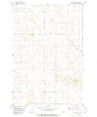
1980 Map of Breien
USGS Topo · Published 1980About this map
The Cannonball River defines the southern portion of this landscape, marking a significant ecological and cultural border within the Standing Rock Indian Reservation Boundary. Near the settlement of Breien, the river is joined by Dogtooth Creek and Chanta Peta Creek, reflecting a water-dependent transport and settlement pattern common in Morton County. The topography is notable for War Dance Hill, which rises prominently above the surrounding plains. An Old Railroad Grade follows the northern bank of the river, tracing a defunct transportation corridor that once linked the local community to the regional economy. This survey documents the area just prior to the 1980s, recording the spatial relationship between the reservation lands and the neighboring township of Solen during a period of relative rural stability.
Find a feature on this map
12 named features on this map. Tap any name to fly to it.
Don’t see what you’re looking for? This feature index may not catch every label — zoom into the map to look around manually.
Map Details
Editions of this 1980 Breien Map
This is the sole edition of this map. No revisions or reprints were ever made.
Other maps of this area

1907 · Bismarck
USGS Topo · 1:125,000

1954 · Bismarck
USGS Topo · 1:250,000

1958 · Bismarck
USGS Topo · 1:250,000

1971 · Half Timber Butte
USGS Topo · 1:24,000

1971 · Solen SW
USGS Topo · 1:24,000

1971 · Timmer
USGS Topo · 1:24,000

1979 · Bismarck
USGS Topo · 1:100,000

1980 · Solen
USGS Topo · 1:24,000
1980 · The Hogback
USGS Topo · 1:24,000

1980 · Burgess
USGS Topo · 1:24,000