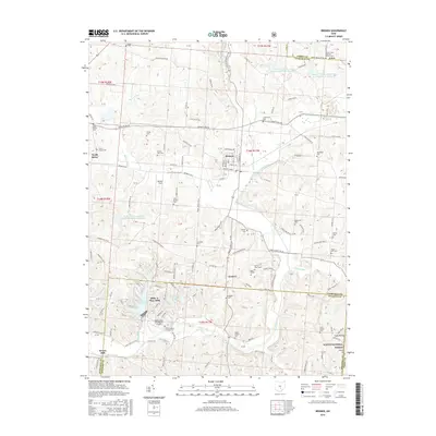
2016 Map of Bremen
USGS Topo · Published 2016About this map
Bremen serves as the central hub of this eastern Fairfield County landscape, where the waters of Little Rush Cr and Rush Creek converge. The settlement pattern is defined by a high density of rural burial grounds and country churches, such as Mount Zion Cem and the Avlon United Brethren Church Cem, reflecting the deep-rooted family genealogies of Rush Creek Township. To the south, the terrain shifts into the planned recreation and residential communities of Hide-A-Way Hills, organized around numerous private water bodies including Lake of Four Seasons and Lake Eagle. This area transitions into the protected timberlands of the Wayne National Forest near Coon Hollow. The map captures a mix of traditional agricultural land holdings and mid-century resort development, complete with local aviation landmarks like Willard Field and the Hide-A-Way Hills Resort Airport.
Find a feature on this map
90 named features on this map. Tap any name to fly to it.
Don’t see what you’re looking for? This feature index may not catch every label — zoom into the map to look around manually.
Map Details
Editions of this 2016 Bremen Map
This is the sole edition of this map. No revisions or reprints were ever made.
Other maps of this area

1907 · Logan
USGS Topo · 1:62,500

1907 · Lancaster
USGS Topo · 1:62,500

1907 · Thurston
USGS Topo · 1:62,500

1909 · Thornville
USGS Topo · 1:62,500

1909 · Lancaster
USGS Topo · 1:62,500

1909 · Logan
USGS Topo · 1:62,500

1909 · Thurston
USGS Topo · 1:62,500

1947 · Columbus
USGS Topo · 1:250,000

1961 · Columbus
USGS Topo · 1:250,000

1961 · Rushville
USGS Topo · 1:24,000