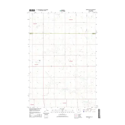
2015 Map of Brewer Butte
USGS Topo · Published 2015About this map
Brewer Butte rises as a prominent landmark in this landscape of the Missouri Plateau, marking the high ground between local drainage basins. The area is defined by the winding course of the Little Moreau River, which meanders across the southern half of the quadrangle, while High Bank Cr drains the northern reaches. This 2015 survey illustrates a largely open, rural landscape partitioned by a geometric grid of county roads such as 133rd St and 248th Ave. The boundary between Corson County and Dewey County cuts directly across the northern section, following the section lines of the Public Land Survey System. The map provides a detailed view of the terrain's transition from river bottomlands to the elevated plateau around the butte, showing how modern county infrastructure like CR-3b and CR-4 traverses this expansive South Dakota prairie.
Find a feature on this map
25 named features on this map. Tap any name to fly to it.
Don’t see what you’re looking for? This feature index may not catch every label — zoom into the map to look around manually.
Map Details
Editions of this 2015 Brewer Butte Map
This is the sole edition of this map. No revisions or reprints were ever made.
Other maps of this area

1953 · McIntosh
USGS Topo · 1:250,000

1956 · Miscol SW
USGS Topo · 1:24,000

1956 · Black Horse SE
USGS Topo · 1:24,000

1956 · Miscol SE
USGS Topo · 1:24,000

1958 · McIntosh
USGS Topo · 1:250,000

1978 · Brewer Butte
USGS Topo · 1:24,000

1978 · Timber Lake
USGS Topo · 1:24,000

1978 · Peach Lake
USGS Topo · 1:24,000

1978 · Little Moreau Lake
USGS Topo · 1:24,000

1978 · Livermant Lake
USGS Topo · 1:24,000