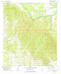
1974 Map of Brewersville
USGS Topo · Published 1978About this map
The Tombigbee River forms a primary natural boundary in the north, where the St Stephens Meridian meets the winding water near Old Bluffport. This mid-1970s landscape reflects a deeply rural community structured around small churches and family burial grounds, including Hawkins Chapel, St Matthews Ch, and the Arrington Cem near Woodford. The terrain is defined by a dense network of tributaries such as Coatopa Creek and Ponkabia Creek, which drain the ridges around High Hill and Armstrong Hill. Transportation history is visible through the Old RR Grade in the southeast and the looping route of Doctor Hester Circle, illustrating how local movement evolved alongside the older rail and river corridors.
Find a feature on this map
38 named features on this map. Tap any name to fly to it.
Don’t see what you’re looking for? This feature index may not catch every label — zoom into the map to look around manually.
Map Details
Editions of this 1974 Brewersville Map
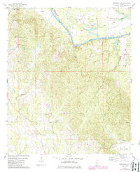
2 editions found
Other maps of this area

1929 · Epes
USGS Topo · 1:48,000

1932 · Epes
USGS Topo · 1:62,500

1947 · Forkland
USGS Topo · 1:24,000

1948 · Mc Dowell
USGS Topo · 1:24,000

1949 · Mc Dowell
USGS Topo · 1:24,000

1949 · Forkland
USGS Topo · 1:24,000

1953 · Montgomery
USGS Topo · 1:250,000

1953 · Meridian
USGS Topo · 1:250,000

1956 · Montgomery
USGS Topo · 1:250,000

1957 · Meridian
USGS Topo · 1:250,000