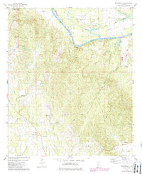
1974 Map of Brewersville
USGS Topo · Published 1986About this map
Lake Demopolis and the winding Tombigbee River define the northern boundary of this region, where the Greene and Sumter County lines meet. This mid-1970s landscape shows the transition of the waterway alongside historical river settlements like Bluffport and Old Bluffport. Further south, the map details a rural interior structured around family-named landmarks and country congregations such as Christian Valley Church and St Matthews Ch. The terrain is marked by significant elevations like Mt Prospect and High Hill, while the local economy is evidenced by a Gravel Pit and the presence of the Woodford settlement near the Meridian line. Numerous family burial grounds, including the Phares Cem, Nebo Cem, and Brewersville Cem, provide valuable data for genealogists tracing the residents of Brewersville and Moore Town.
Find a feature on this map
38 named features on this map. Tap any name to fly to it.
Don’t see what you’re looking for? This feature index may not catch every label — zoom into the map to look around manually.
Map Details
Editions of this 1974 Brewersville Map
2 editions found
Other maps of this area

1929 · Epes
USGS Topo · 1:48,000

1932 · Epes
USGS Topo · 1:62,500

1947 · Forkland
USGS Topo · 1:24,000

1948 · Mc Dowell
USGS Topo · 1:24,000

1949 · Mc Dowell
USGS Topo · 1:24,000

1949 · Forkland
USGS Topo · 1:24,000

1953 · Montgomery
USGS Topo · 1:250,000

1953 · Meridian
USGS Topo · 1:250,000

1956 · Montgomery
USGS Topo · 1:250,000

1957 · Meridian
USGS Topo · 1:250,000