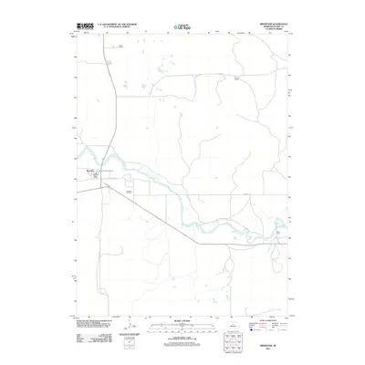
2011 Map of Brewster
USGS Topo · Published 2011About this map
Brewster serves as the focal point of this Blaine County landscape, where the North Loup River meanders through the Nebraska Sandhills. The settlement’s essential services are clearly marked, including the Brewster Post Office and the Brewster Cemetery located just to the south. This area is characterized by a sprawling ranching economy, represented by family-named holdings such as Burke Ranch, Niemoth Ranch, and Miller Ranch scattered across the river valley and upland plains.
Find a feature on this map
12 named features on this map. Tap any name to fly to it.
Don’t see what you’re looking for? This feature index may not catch every label — zoom into the map to look around manually.
Map Details
Editions of this 2011 Brewster Map
This is the sole edition of this map. No revisions or reprints were ever made.
Other maps of this area

1952 · Brewster
USGS Topo · 1:24,000

1952 · Almeria NW
USGS Topo · 1:24,000

1952 · Almeria SW
USGS Topo · 1:24,000

1952 · Brewster SE
USGS Topo · 1:24,000

1952 · Brewster SW
USGS Topo · 1:24,000

1952 · Brewster NW
USGS Topo · 1:24,000

1955 · Broken Bow
USGS Topo · 1:250,000

1955 · O'Neill
USGS Topo · 1:250,000

1956 · Broken Bow
USGS Topo · 1:250,000

1959 · O'Neill
USGS Topo · 1:250,000