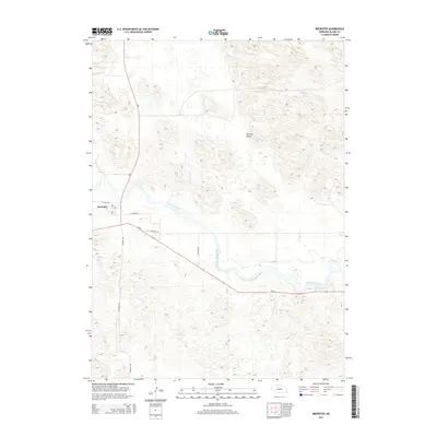
2014 Map of Brewster
USGS Topo · Published 2014About this map
Brewster serves as the central point of this Nebraska Sandhills landscape, situated where Ne-7 and Ne-91 converge. The settlement sits just south of the North Loup River, which carves a distinct path through the rolling dunes. To the northeast, the terrain opens into German Valley, a name reflecting the heritage of early agricultural settlers who managed the unique challenges of ranching and farming in this sandy environment. The grid of modern roads, including Milburn Ave and the N Loup Spur, provides a framework for understanding current land use against the natural topography. For those researching local roots, the Brewster Cem is clearly marked southeast of the town center, offering a key landmark for genealogical study in Blaine County.
Find a feature on this map
10 named features on this map. Tap any name to fly to it.
Don’t see what you’re looking for? This feature index may not catch every label — zoom into the map to look around manually.
Map Details
Editions of this 2014 Brewster Map
This is the sole edition of this map. No revisions or reprints were ever made.
Other maps of this area

1952 · Brewster
USGS Topo · 1:24,000

1952 · Almeria NW
USGS Topo · 1:24,000

1952 · Almeria SW
USGS Topo · 1:24,000

1952 · Brewster SE
USGS Topo · 1:24,000

1952 · Brewster SW
USGS Topo · 1:24,000

1952 · Brewster NW
USGS Topo · 1:24,000

1955 · Broken Bow
USGS Topo · 1:250,000

1955 · O'Neill
USGS Topo · 1:250,000

1956 · Broken Bow
USGS Topo · 1:250,000

1959 · O'Neill
USGS Topo · 1:250,000