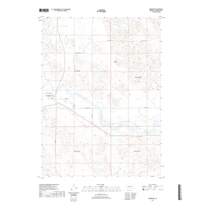
2017 Map of Brewster
USGS Topo · Published 2017About this map
Brewster serves as the focal point of this Nebraska Sandhills survey, situated along a prominent bend of the North Loup River. The village layout is tightly defined by a network of local routes, including W North Loup Rd and Milburn Rd, reflecting its role as a local crossroads in Blaine County. The surrounding terrain is characterized by the distinct landforms of German Valley to the northeast, where the elevation rises away from the river plains into the undulating hills. Genealogists and local historians will find the Brewster Cem located south of the main settlement, near the junction of several rural tracks. The map illustrates the sparse, ranch-oriented settlement pattern of the early 21st century, where large tracts are connected by gravel and dirt roads like Pleasant Valley Rd.
Find a feature on this map
13 named features on this map. Tap any name to fly to it.
Don’t see what you’re looking for? This feature index may not catch every label — zoom into the map to look around manually.
Map Details
Editions of this 2017 Brewster Map
This is the sole edition of this map. No revisions or reprints were ever made.
Other maps of this area

1952 · Brewster
USGS Topo · 1:24,000

1952 · Almeria NW
USGS Topo · 1:24,000

1952 · Almeria SW
USGS Topo · 1:24,000

1952 · Brewster SE
USGS Topo · 1:24,000

1952 · Brewster SW
USGS Topo · 1:24,000

1952 · Brewster NW
USGS Topo · 1:24,000

1955 · Broken Bow
USGS Topo · 1:250,000

1955 · O'Neill
USGS Topo · 1:250,000

1956 · Broken Bow
USGS Topo · 1:250,000

1959 · O'Neill
USGS Topo · 1:250,000