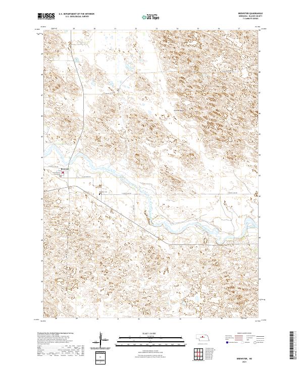
2021 Map of Brewster
USGS Topo · Published 2021About this map
Brewster serves as the focal point of this Blaine County landscape, where the Blaine County Courthouse stands as a central civic landmark near the banks of the North Loup River. The river valley dictates the local infrastructure, with routes like W North Loup Rd and E North Loup Rd following the water's course through the Sandhills region. To the north, the settlement of German Valley and the expanse of Pleasant Valley Rd illustrate the dispersed nature of high-plains ranching communities.
Find a feature on this map
15 named features on this map. Tap any name to fly to it.
Don’t see what you’re looking for? This feature index may not catch every label — zoom into the map to look around manually.
Map Details
Editions of this 2021 Brewster Map
This is the sole edition of this map. No revisions or reprints were ever made.
Other maps of this area

1952 · Brewster
USGS Topo · 1:24,000

1952 · Almeria NW
USGS Topo · 1:24,000

1952 · Almeria SW
USGS Topo · 1:24,000

1952 · Brewster SE
USGS Topo · 1:24,000

1952 · Brewster SW
USGS Topo · 1:24,000

1952 · Brewster NW
USGS Topo · 1:24,000

1955 · Broken Bow
USGS Topo · 1:250,000

1955 · O'Neill
USGS Topo · 1:250,000

1956 · Broken Bow
USGS Topo · 1:250,000

1959 · O'Neill
USGS Topo · 1:250,000