
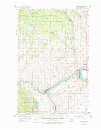
1957 Map of Brewster
USGS Topo · Published 1959About this map
The Columbia River and Methow River converge in this mid-century survey, defining the industrial and agricultural character of the Okanogan valley. The town of Brewster serves as a primary hub along the Northern Pacific RR, featuring a network of infrastructure including a Pumping Plant, Surge Tank, and a Gravel Pit. To the west, Pateros marks the junction where the Methow flows into the Columbia, near the Methow Rapids.
Find a feature on this map
45 named features on this map. Tap any name to fly to it.
Don’t see what you’re looking for? This feature index may not catch every label — zoom into the map to look around manually.
Map Details
Editions of this 1957 Brewster Map
2 editions found
Other maps of this area

1899 · Methow
USGS Topo · 1:125,000

1901 · Chelan
USGS Topo · 1:125,000

1901 · Methow
USGS Topo · 1:125,000

1905 · Okanogan
USGS Topo · 1:125,000

1953 · Ritzville
USGS Topo · 1:250,000

1954 · Okanogan
USGS Topo · 1:250,000

1955 · Concrete
USGS Topo · 1:250,000

1956 · Loup Loup
USGS Topo · 1:62,500

1957 · Okanogan
USGS Topo · 1:62,500

1957 · Bridgeport
USGS Topo · 1:62,500