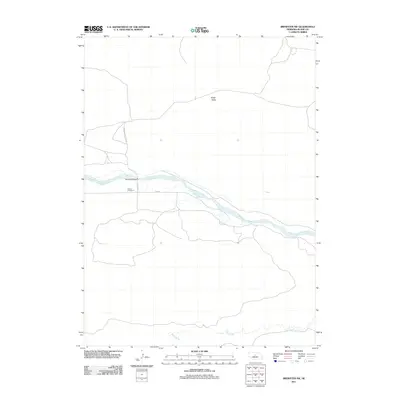
2011 Map of Brewster SW
USGS Topo · Published 2011About this map
The Middle Loup River winds through the heart of Blaine County, defining the rural landscape of this central Nebraska region. In the early 21st century, the terrain remains characterized by the broad drainage of Edith Valley and the sparse network of gravel roads that cross the prairie. A notable landmark for local history is Loughran Bridge, which provides a crossing over the river near the location of School Number 21, a remaining marker of the district's educational layout. To the south, the map tracks the path of Rifle Creek, showing a landscape largely dedicated to open range and traditional Nebraska ranchland. The layout of Middle Loup River Rd and various county routes, such as Co RD 4, illustrates the enduring reliance on these corridors for connecting the isolated homesteads and valleys of the Sandhills region.
Find a feature on this map
8 named features on this map. Tap any name to fly to it.
Don’t see what you’re looking for? This feature index may not catch every label — zoom into the map to look around manually.
Map Details
Editions of this 2011 Brewster SW Map
This is the sole edition of this map. No revisions or reprints were ever made.
Other maps of this area

1948 · Linscott
USGS Topo · 1:62,500

1950 · Linscott
USGS Topo · 1:62,500

1951 · Dunning
USGS Topo · 1:62,500

1951 · Anselmo NE
USGS Topo · 1:24,000

1951 · Anselmo NW
USGS Topo · 1:24,000

1952 · Brewster
USGS Topo · 1:24,000

1952 · Brewster SE
USGS Topo · 1:24,000

1952 · Brewster SW
USGS Topo · 1:24,000

1952 · Brewster NW
USGS Topo · 1:24,000

1954 · North Platte
USGS Topo · 1:250,000