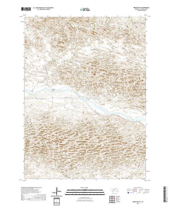
2021 Map of Brewster SW
USGS Topo · Published 2021About this map
The Middle Loup River meanders across the center of this Nebraska Sandhills terrain, defining the local geography and infrastructure. The Laughran Bridge provides a primary crossing point, connecting the northern hills with the Middle Loup River Rd that skirts the southern bank. To the north, the broad expanse of Edith Valley stands out among the characteristic dune-like topography. The southeastern portion of the map is drained by Rifle Cr, illustrating the sparse but vital water network of Blaine County. Surveyed by the U.S. Geological Survey, the map documents the established township boundaries including t22n r23w and t21n r23w, alongside a local road network that includes Roseberry Rd and W Milburn Rd.
Find a feature on this map
11 named features on this map. Tap any name to fly to it.
Don’t see what you’re looking for? This feature index may not catch every label — zoom into the map to look around manually.
Map Details
Editions of this 2021 Brewster SW Map
This is the sole edition of this map. No revisions or reprints were ever made.
Other maps of this area

1948 · Linscott
USGS Topo · 1:62,500

1950 · Linscott
USGS Topo · 1:62,500

1951 · Dunning
USGS Topo · 1:62,500

1951 · Anselmo NE
USGS Topo · 1:24,000

1951 · Anselmo NW
USGS Topo · 1:24,000

1952 · Brewster
USGS Topo · 1:24,000

1952 · Brewster SE
USGS Topo · 1:24,000

1952 · Brewster SW
USGS Topo · 1:24,000

1952 · Brewster NW
USGS Topo · 1:24,000

1954 · North Platte
USGS Topo · 1:250,000