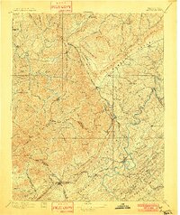
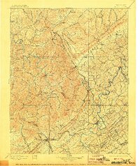
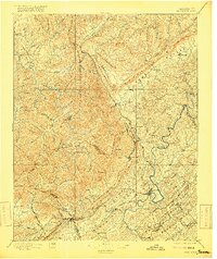
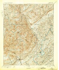
1896 Map of Briceville
USGS Topo · Published 1901About this map
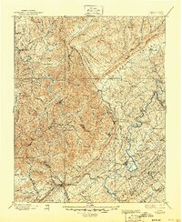
The Southern R. R. and several specialized rail lines, such as the Jellico Div. and the Knoxville and Ohio Div., pierce the dense ridges of the Cumberland Plateau in this late 19th-century survey. The landscape is defined by its deep narrow valleys and prominent heights like Walden Ridge and Cross Mtn.. In the lowlands, Clinton and Jacksboro serve as early hubs of activity, while the interior is dotted with remote settlements like Podopholine and Almy. The map reveals an industrializing wilderness where coal and timber interests follow the river paths of the New River and Buffalo Creek. Distinctive landmarks such as Frozen Head and Pilot Knob provide essential orientation for early travelers and surveyors navigating the complex topography of Anderson and Campbell counties.
Find a feature on this map
152 named features on this map. Tap any name to fly to it.
Don’t see what you’re looking for? This feature index may not catch every label — zoom into the map to look around manually.
Map Details
Editions of this 1896 Briceville Map
6 editions found

Other maps of this area

1886 · Knoxville
USGS Topo · 1:125,000

1886 · Cumberland Gap
USGS Topo · 1:125,000

1887 · Kingston
USGS Topo · 1:125,000

1888 · Cumberland Gap
USGS Topo · 1:125,000

1890 · Williamsburg
USGS Topo · 1:125,000

1891 · Cumberland Gap
USGS Topo · 1:125,000

1891 · Kingston
USGS Topo · 1:125,000

1892 · Knoxville
USGS Topo · 1:125,000

1893 · Briceville
USGS Topo · 1:125,000

1893 · Kingston
USGS Topo · 1:125,000