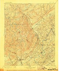
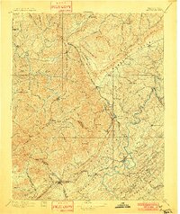
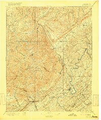
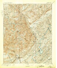
1896 Map of Briceville
USGS Topo · Published 1906About this map
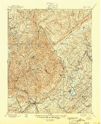
Clinton and Jacksboro anchor this turn-of-the-century topographic portrait of Eastern Tennessee's coal-rich ridge country. The landscape is dominated by the massive parallel formations of Cumberland Mountain and Walden Ridge, which dictate the paths of early settlements and the Southern R. R. through the valleys. The map documents the industrial emergence of Briceville and Caryville, situated at the feet of high peaks like Cross Mtn. and Wind Rock.
Find a feature on this map
123 named features on this map. Tap any name to fly to it.
Don’t see what you’re looking for? This feature index may not catch every label — zoom into the map to look around manually.
Map Details
Editions of this 1896 Briceville Map
6 editions found

Other maps of this area

1886 · Knoxville
USGS Topo · 1:125,000

1886 · Cumberland Gap
USGS Topo · 1:125,000

1887 · Kingston
USGS Topo · 1:125,000

1888 · Cumberland Gap
USGS Topo · 1:125,000

1890 · Williamsburg
USGS Topo · 1:125,000

1891 · Cumberland Gap
USGS Topo · 1:125,000

1891 · Kingston
USGS Topo · 1:125,000

1892 · Knoxville
USGS Topo · 1:125,000

1893 · Briceville
USGS Topo · 1:125,000

1893 · Kingston
USGS Topo · 1:125,000