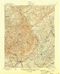
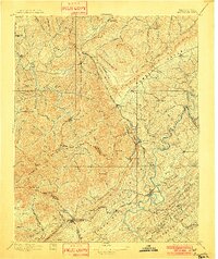
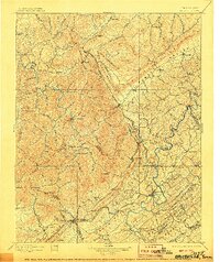
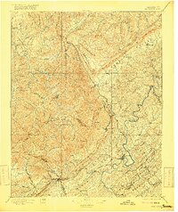
1896 Map of Briceville
USGS Topo · Published 1945About this map
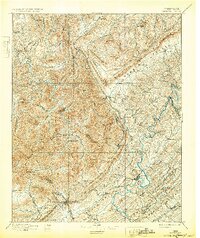
The rugged intersection of Cumberland Mountain and the Tennessee Valley defines this 1880s-era landscape, where coal mining and early rail infrastructure were rapidly reshaping the region. Prominent ridges like Cross Mountain and Black Oak Ridge run parallel to the Clinch River, creating a corridor for the Knoxville And Ohio Rr. This transportation network supported growing industrial centers like Briceville, Oliver Springs, and Clinton, while more remote mountain settlements like Huntsville and Norma remained centered on timber and river access. The map reveals the early footprint of extractive industries before the 20th-century development of the region's larger dams and reservoirs. Local history researchers can trace original property lines and early community hubs such as Andersonville, Caryville, and the ferry crossing at Blacks Ford, illustrating the transition from a wilderness frontier to an industrial Appalachian heartland.
Find a feature on this map
110 named features on this map. Tap any name to fly to it.
Don’t see what you’re looking for? This feature index may not catch every label — zoom into the map to look around manually.
Map Details
Editions of this 1896 Briceville Map
6 editions found

Other maps of this area

1886 · Knoxville
USGS Topo · 1:125,000

1886 · Cumberland Gap
USGS Topo · 1:125,000

1887 · Kingston
USGS Topo · 1:125,000

1888 · Cumberland Gap
USGS Topo · 1:125,000

1890 · Williamsburg
USGS Topo · 1:125,000

1891 · Cumberland Gap
USGS Topo · 1:125,000

1891 · Kingston
USGS Topo · 1:125,000

1892 · Knoxville
USGS Topo · 1:125,000

1893 · Briceville
USGS Topo · 1:125,000

1893 · Kingston
USGS Topo · 1:125,000