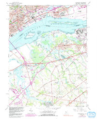
1967 Map of Bridgeport
USGS Topo · Published 1991About this map
The industrial and maritime activity along the Delaware River defines this 1967 survey, where the heavy infrastructure of Chester and Paulsboro meets the marshes of the New Jersey shore. The map documents a complex landscape of movement, from the high-density rail corridors of Conrail and the New Jersey Toll Turnpike to the shifting tidal flats around Monds Island and Raccoon Island. Urban expansion is visible in the purple-tinted growth of Gibbstown and Bridgeport, while the northern banks feature the prominent Pennsylvania Mil College and industrial landmarks like the Westinghouse Village.
Find a feature on this map
107 named features on this map. Tap any name to fly to it.
Don’t see what you’re looking for? This feature index may not catch every label — zoom into the map to look around manually.
Map Details
Editions of this 1967 Bridgeport Map
4 editions found
Other maps of this area

1890 · Salem
USGS Topo · 1:62,500

1890 · Glassboro
USGS Topo · 1:62,500

1891 · Philadelphia
USGS Topo · 1:62,500

1894 · Chester
USGS Topo · 1:62,500

1894 · Philadelphia
USGS Topo · 1:62,500

1896 · Philadelphia
USGS Topo · 1:62,500

1896 · Chester
USGS Topo · 1:62,500

1898 · Salem
USGS Topo · 1:62,500

1898 · Glassboro
USGS Topo · 1:62,500

1898 · Chester
USGS Topo · 1:62,500