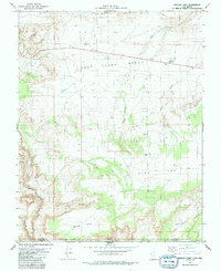
1981 Map of Bridger Point
USGS Topo · Published 1991About this map
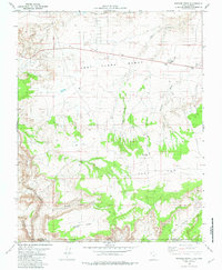
East Clark Bench dominates this high-desert landscape on the border of Utah and Arizona, where 1970s photogrammetric mapping captures a region defined by dramatic vertical relief and sparse human infrastructure. The northern reaches are characterized by the jagged edges of The Rimrocks, while the southern portion drops precipitously into the deep incisions of Paria River Canyon and Buckskin Gulch. Human presence is concentrated along the corridor of Route 89, marked by a small Trailer Park and Church Well. The terrain transition is stark, moving from the broad expanse of Flat Top down toward the intricate drainages of Judd Hollow and Bridger Canyon. This survey provides a precise look at the landforms of the Colorado Plateau before modern development, including the prominent landmark of Bridger Point near the state line.
Find a feature on this map
18 named features on this map. Tap any name to fly to it.
Don’t see what you’re looking for? This feature index may not catch every label — zoom into the map to look around manually.
Map Details
Editions of this 1981 Bridger Point Map
3 editions found
Historical Maps of Coconino County Through Time
152 maps found

1922 Rees Canyon
Kane County, UT

1922 Upper Last Chance
Kane County, UT

1922 Warm Creek
Kane County, UT

1953 Cummings Mesa
Kane County, UT

1953 Gunsight Butte
Kane County, UT

1953 Nipple Butte
Kane County, UT

1953 No Mans Mesa
Kane County, UT

1953 The Rincon
Kane County, UT

1954 Buckskin Gulch NE
Kane County, UT

1954 Buckskin Gulch NW
Kane County, UT

1954 Buckskin Gulch SE
Kane County, UT

1954 Buckskin Gulch SW
Kane County, UT

1954 Johnson
Kane County, UT

1954 Johnson NE
Kane County, UT

1954 Johnson SE
Kane County, UT

1954 Johnson SW
Kane County, UT

1954 Kanab SE
Kane County, UT

1954 Kanab SW
Kane County, UT

1954 Orderville Canyon SE
Kane County, UT

1954 Paria
Kane County, UT

1954 Paria NW
Kane County, UT

1954 Paria SW
Kane County, UT

1954 Telegraph Flat
Kane County, UT

1955 The Cockscob SW
Kane County, UT

1956 Springdale NE
Kane County, UT

1956 Springdale SE
Kane County, UT

1957 Orderville Canyon NE
Kane County, UT

1964 Butler Valley
Kane County, UT

1964 Calico Peak
Kane County, UT

1964 Horse Flat
Kane County, UT

1964 Slickrock Bench
Kane County, UT

1966 Bald Knoll
Kane County, UT

1966 Bull Valley Gorge
Kane County, UT

1966 Deer Range Point
Kane County, UT

1966 Deer Spring Point
Kane County, UT

1966 Podunk Creek
Kane County, UT

1966 Rainbow Point
Kane County, UT

1966 Skutumpah Creek
Kane County, UT

1968 Basin Canyon
Kane County, UT

1968 Big Hollow Wash
Kane County, UT

1968 Blackburn Canyon
Kane County, UT

1968 Collet Top
Kane County, UT

1968 East of The Navajo
Kane County, UT

1968 Fourmile Bench
Kane County, UT

1968 Horse Mtn
Kane County, UT

1968 King Mesa
Kane County, UT

1968 Needle Eye Point
Kane County, UT

1968 Petes Cove
Kane County, UT

1968 Ship Mountain Point
Kane County, UT

1968 Sooner Bench
Kane County, UT

1980 Clear Creek Mountain
Kane County, UT

1980 Elephant Butte
Kane County, UT

1980 Straight Canyon
Kane County, UT

1980 The Barracks
Kane County, UT

1981 Bridger Point
Kane County, UT

1981 Fivemile Valley
Kane County, UT

1981 Glen Canyon City
Kane County, UT

1981 Lone Rock
Kane County, UT

1981 Lower Coyote Spring
Kane County, UT

1981 Nipple Butte
Kane County, UT

1981 Tibbet Bench
Kane County, UT

1981 West Clark Bench
Kane County, UT

1985 Gregory Butte
Kane County, UT

1985 Gunsight Butte
Kane County, UT

1985 Long Valley Junction
Kane County, UT

1985 Mazuki Point
Kane County, UT

1985 Mount Carmel
Kane County, UT

1985 Navajo Point
Kane County, UT

1985 Sit Down Bench
Kane County, UT

1985 Smoky Hollow
Kane County, UT

1985 Smoky Mountain
Kane County, UT

1985 Strawberry Point
Kane County, UT

1985 Warm Creek Bay
Kane County, UT

1985 White Tower
Kane County, UT

1985 Yellowjacket Canyon
Kane County, UT

1987 Cutler Point
Kane County, UT

1987 Davis Gulch
Kane County, UT

1987 Eightmile Pass
Kane County, UT

1987 Johnson Lakes
Kane County, UT

1987 Nasja Mesa
Kane County, UT

1987 Nephi Point
Kane County, UT

1987 Petrified Hollow
Kane County, UT

1987 Pine Hollow Canyon
Kane County, UT

1987 Pine Point
Kane County, UT

1987 Stevens Canyon South
Kane County, UT

1987 The Rincon NE
Kane County, UT

1987 Thompson Point
Kane County, UT

1997 King Mesa
Kane County, UT

1997 Stevens Canyon South
Kane County, UT

2002 Long Valley Junction
Kane County, UT

2002 Podunk Creek
Kane County, UT

2002 Rainbow Point
Kane County, UT

2002 Straight Canyon
Kane County, UT

2002 Strawberry Point
Kane County, UT

2023 Bald Knoll
Kane County, UT

2023 Basin Canyon
Kane County, UT

2023 Big Hollow Wash
Kane County, UT

2023 Blackburn Canyon
Kane County, UT
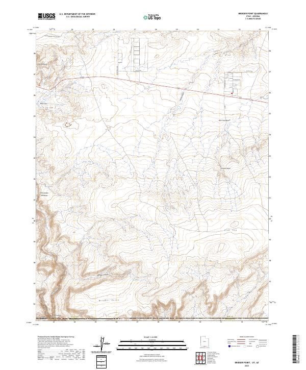
2023 Bridger Point
Kane County, UT

2023 Bull Valley Gorge
Kane County, UT
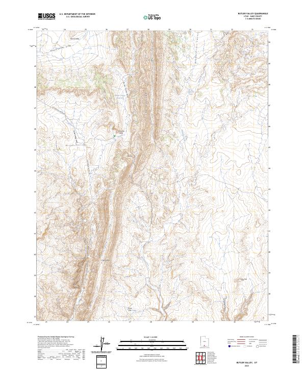
2023 Butler Valley
Kane County, UT

2023 Calico Peak
Kane County, UT

2023 Clear Creek Mountain
Kane County, UT
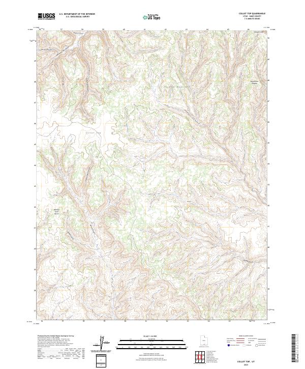
2023 Collet Top
Kane County, UT

2023 Cutler Point
Kane County, UT

2023 Davis Gulch
Kane County, UT

2023 Deer Range Point
Kane County, UT

2023 Deer Spring Point
Kane County, UT
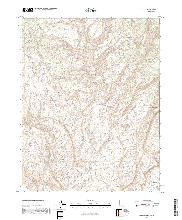
2023 East of the Navajo
Kane County, UT

2023 Eightmile Pass
Kane County, UT

2023 Elephant Butte
Kane County, UT

2023 Fivemile Valley
Kane County, UT
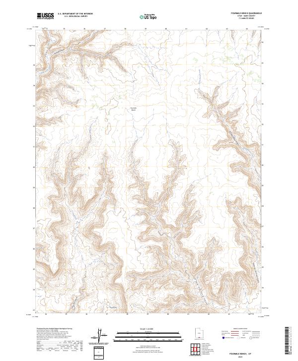
2023 Fourmile Bench
Kane County, UT

2023 Gregory Butte
Kane County, UT

2023 Gunsight Butte
Kane County, UT
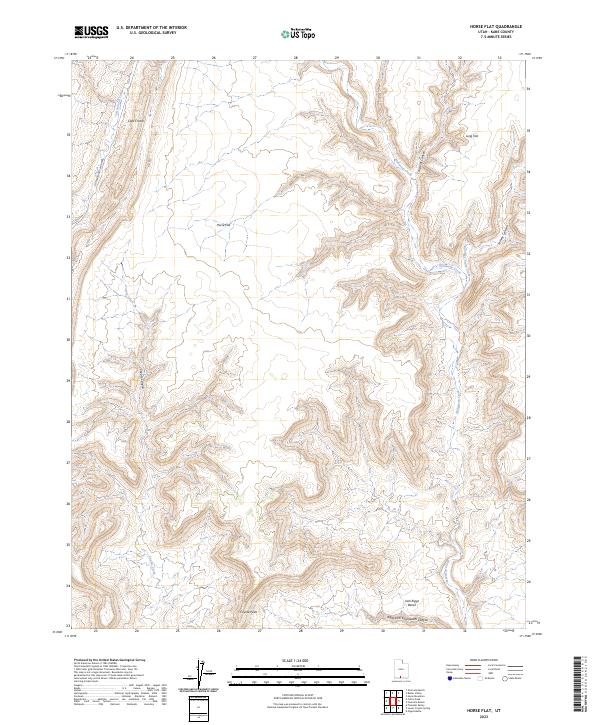
2023 Horse Flat
Kane County, UT
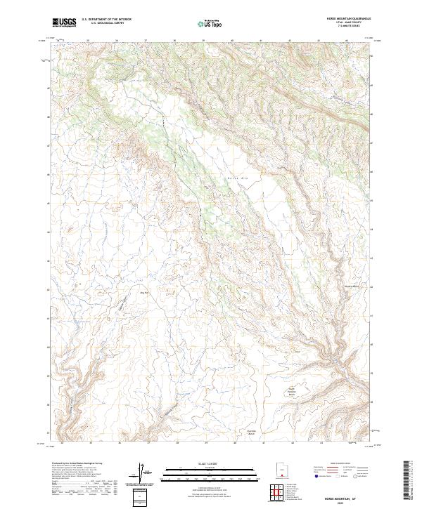
2023 Horse Mountain
Kane County, UT

2023 Johnson Lakes
Kane County, UT

2023 King Mesa
Kane County, UT

2023 Lone Rock
Kane County, UT

2023 Long Valley Junction
Kane County, UT
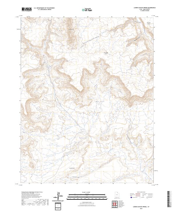
2023 Lower Coyote Spring
Kane County, UT

2023 Mazuki Point
Kane County, UT

2023 Mount Carmel
Kane County, UT

2023 Nasja Mesa
Kane County, UT

2023 Navajo Point
Kane County, UT
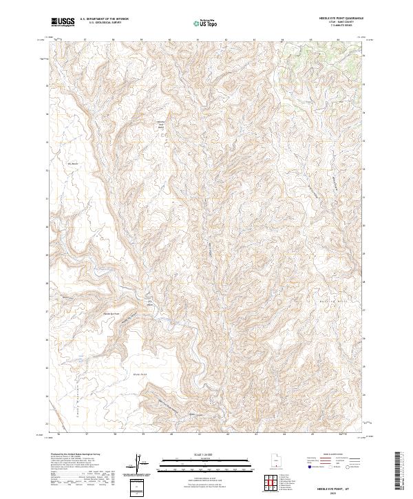
2023 Needle Eye Point
Kane County, UT

2023 Nephi Point
Kane County, UT
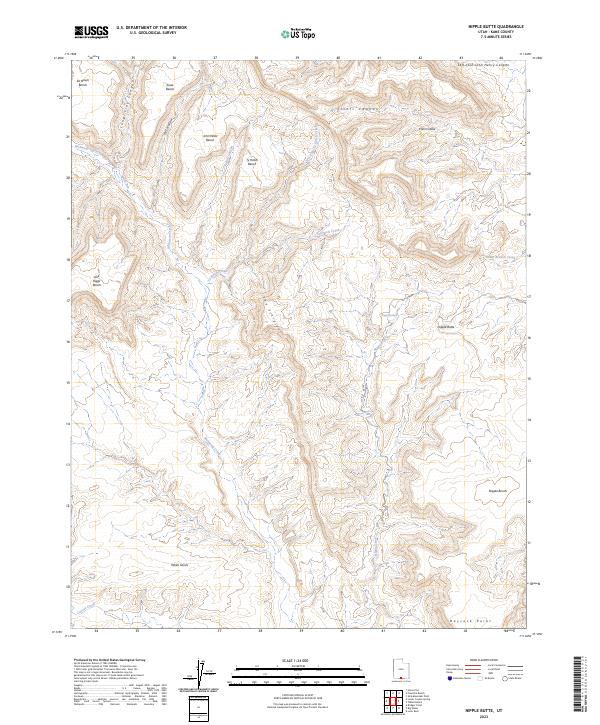
2023 Nipple Butte
Kane County, UT

2023 Petes Cove
Kane County, UT

2023 Petrified Hollow
Kane County, UT

2023 Pine Hollow Canyon
Kane County, UT

2023 Pine Point
Kane County, UT

2023 Podunk Creek
Kane County, UT

2023 Rainbow Point
Kane County, UT
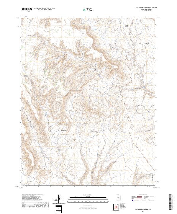
2023 Ship Mountain Point
Kane County, UT

2023 Sit Down Bench
Kane County, UT

2023 Skutumpah Creek
Kane County, UT
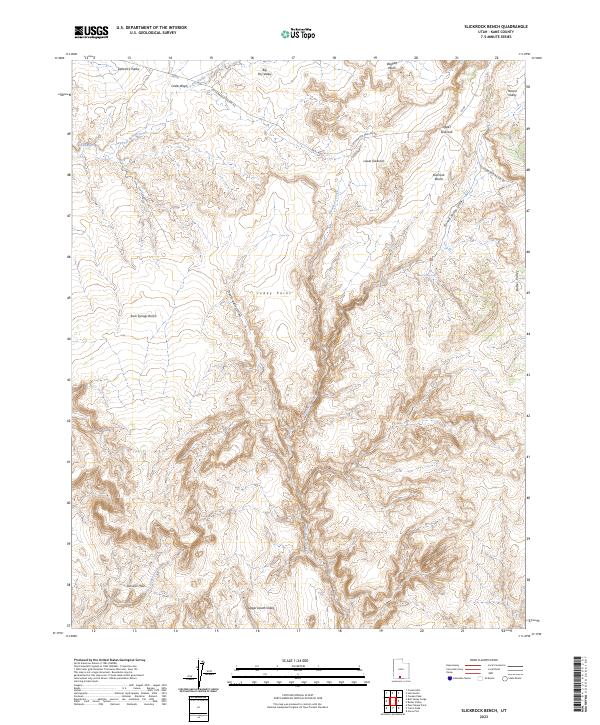
2023 Slickrock Bench
Kane County, UT

2023 Smoky Hollow
Kane County, UT

2023 Sooner Bench
Kane County, UT

2023 Stevens Canyon South
Kane County, UT

2023 Straight Canyon
Kane County, UT

2023 Strawberry Point
Kane County, UT

2023 The Barracks
Kane County, UT

2023 The Rincon NE
Kane County, UT

2023 Thompson Point
Kane County, UT

2023 Tibbet Bench
Kane County, UT

2023 Warm Creek Bay
Kane County, UT

2023 West Clark Bench
Kane County, UT

2023 White Tower
Kane County, UT
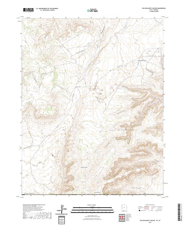
2023 Yellowjacket Canyon
Kane County, UT