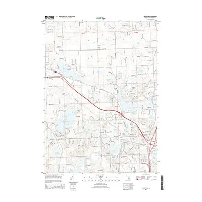
2014 Map of Brighton
USGS Topo · Published 2014About this map
Brighton serves as the central hub of this Michigan landscape, showing a dense network of residential streets and local landmarks. The area is characterized by an exceptional concentration of water bodies, including the expansive Woodland Lake, Brighton Lake, and Lake Chemung. To the southwest, the smaller settlement of Chilson sits near the Chilson Impoundment, reflecting a more rural character compared to the growing municipal center.
Find a feature on this map
255 named features on this map. Tap any name to fly to it.
Don’t see what you’re looking for? This feature index may not catch every label — zoom into the map to look around manually.
Map Details
Editions of this 2014 Brighton Map
This is the sole edition of this map. No revisions or reprints were ever made.
Other maps of this area

1902 · South Lyon
USGS Topo · 1:62,500

1902 · Dexter
USGS Topo · 1:62,500

1904 · Ann Arbor
USGS Topo · 1:125,000

1906 · Dexter
USGS Topo · 1:62,500

1906 · South Lyon
USGS Topo · 1:62,500

1907 · Howell
USGS Topo · 1:62,500

1908 · Ann Arbor
USGS Topo · 1:125,000

1909 · Howell
USGS Topo · 1:62,500

1909 · Milford
USGS Topo · 1:62,500

1954 · Detroit
USGS Topo · 1:250,000
Featured Places
- Hamburg Township, MI
- Genoa Charter Township, MI
- Green Oak Charter Township, MI
- Brighton Charter Township, MI
- Hartland Township, MI