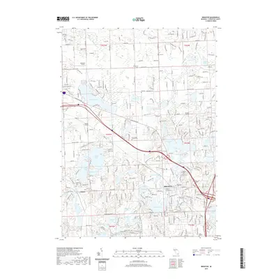
2019 Map of Brighton
USGS Topo · Published 2019About this map
Brighton serves as the focal point for this survey of southeastern Livingston County, where the transition from municipal center to glacial lake country is clearly defined. The area is dense with historical burial grounds including Fairview Cem, Old Brighton Village Cem, and Saint George Lutheran Cem, providing significant touchpoints for genealogical research. Water dominates the western landscape, marked by the connected basins of East Crooked Lake, West Crooked Lake, and Lake Chemung, while the Chesapeake and Ohio RR cuts a diagonal path toward the settlement of Chilson. The presence of several airfields like Haigh Airport and Raether Airport reflects the region's mid-century aviation development alongside established recreational areas such as the Brighton Rec. Area. This era of the landscape shows a matured road network intermixed with natural drainage systems like South Ore Creek and the Marion and Genoa Drain.
Find a feature on this map
292 named features on this map. Tap any name to fly to it.
Don’t see what you’re looking for? This feature index may not catch every label — zoom into the map to look around manually.
Map Details
Editions of this 2019 Brighton Map
This is the sole edition of this map. No revisions or reprints were ever made.
Other maps of this area

1902 · South Lyon
USGS Topo · 1:62,500

1902 · Dexter
USGS Topo · 1:62,500

1904 · Ann Arbor
USGS Topo · 1:125,000

1906 · Dexter
USGS Topo · 1:62,500

1906 · South Lyon
USGS Topo · 1:62,500

1907 · Howell
USGS Topo · 1:62,500

1908 · Ann Arbor
USGS Topo · 1:125,000

1909 · Howell
USGS Topo · 1:62,500

1909 · Milford
USGS Topo · 1:62,500

1954 · Detroit
USGS Topo · 1:250,000
Featured Places
- Hamburg Township, MI
- Genoa Charter Township, MI
- Green Oak Charter Township, MI
- Brighton Charter Township, MI
- Hartland Township, MI