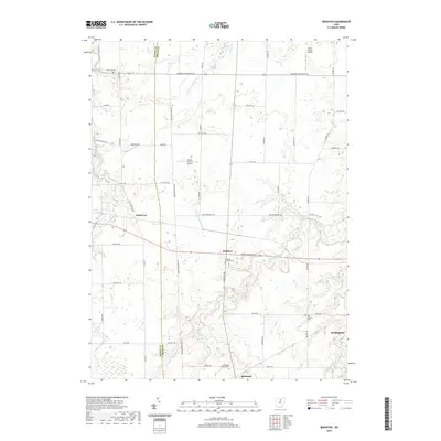
2019 Map of Brighton
USGS Topo · Published 2019About this map
Brighton serves as a central hub for this landscape on the Lorain and Huron County line, where the headwaters of the W Br Black River and E Fork Vermilion River divide the drainage basins. The settlement pattern is characterized by long-established farmsteads and rural crossroads like White Fox and the village of Rochester. Local history and genealogy are well-represented by numerous burial grounds, including the Old Brighton Cem and the Brighton Township Cem along Medina-Norwalk Rd. Aviation plays a notable role in the area's modern land use, with private airstrips such as Ross Airport and Double S Farms Airport punctuating the grid of township roads. The map also traces the northern reaches of Wellington and the path of the West Branch Black River as it winds toward the lake plains.
Find a feature on this map
50 named features on this map. Tap any name to fly to it.
Don’t see what you’re looking for? This feature index may not catch every label — zoom into the map to look around manually.
Map Details
Editions of this 2019 Brighton Map
This is the sole edition of this map. No revisions or reprints were ever made.
Other maps of this area

1901 · Oberlin
USGS Topo · 1:62,500

1903 · Vermilion
USGS Topo · 1:62,500

1903 · Oberlin
USGS Topo · 1:62,500

1904 · Wellington
USGS Topo · 1:62,500

1906 · Wellington
USGS Topo · 1:62,500

1908 · New London
USGS Topo · 1:62,500

1956 · Toledo
USGS Topo · 1:250,000

1959 · Berlin Heights
USGS Topo · 1:24,000

1959 · Kipton
USGS Topo · 1:24,000

1960 · Oberlin
USGS Topo · 1:24,000