
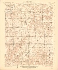
1928 Map of Brighton
USGS Topo · Published 1928About this map
Macoupin Creek and its winding tributaries define the rural landscape of this southwestern Illinois region in the 1920s. This survey illustrates a densely settled agricultural grid across Greene, Jersey, and Macoupin Counties, where small towns like Medora, Shipman, and Brighton served as vital hubs for the surrounding farming community. The area is exceptionally well-documented for its social infrastructure, featuring dozens of country schools such as Washington School and Brush College School, alongside landmarks like Paradise Church.
Find a feature on this map
64 named features on this map. Tap any name to fly to it.
Don’t see what you’re looking for? This feature index may not catch every label — zoom into the map to look around manually.
Map Details
Editions of this 1928 Brighton Map
2 editions found
Other maps of this area

1912 · Gillespie
USGS Topo · 1:62,500

1915 · Gillespie
USGS Topo · 1:62,500

1923 · Carlinville
USGS Topo · 1:48,000

1924 · Roodhouse
USGS Topo · 1:62,500

1925 · Carlinville
USGS Topo · 1:62,500

1925 · Brighton
USGS Topo · 1:62,500

1926 · Roodhouse
USGS Topo · 1:62,500

1927 · Alton
USGS Topo · 1:62,500

1927 · St. Charles
USGS Topo · 1:62,500

1927 · Edwardsville
USGS Topo · 1:62,500