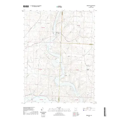
2019 Map of Brinkhaven
USGS Topo · Published 2019About this map
Brinkhaven and the adjacent village of Gann sit at a significant bend in the Mohican River, where the valley walls transition from the heights of Turkey Ridge to the lowlands along the Kokosing River. This landscape is defined by the sharp meanders of the Mohican as it carves through Tager Valley, creating a corridor for early travel and commerce near the tri-county corner of Knox, Holmes, and Coshocton. Settlement patterns follow these waterways and the high ground of Yankee Ridge, with small hamlets like Tiverton Center and Cavallo serving as focal points for the surrounding rural townships. Genealogists will find a wealth of specific local history through numerous family and community burial sites, including Tiverton Baptist Cem, Hollister Cem, and McKee Cem, which are scattered throughout the hills and valley floors.
Find a feature on this map
95 named features on this map. Tap any name to fly to it.
Don’t see what you’re looking for? This feature index may not catch every label — zoom into the map to look around manually.
Map Details
Editions of this 2019 Brinkhaven Map
This is the sole edition of this map. No revisions or reprints were ever made.
Other maps of this area

1912 · Loudonville
USGS Topo · 1:62,500

1912 · Gambier
USGS Topo · 1:62,500

1912 · Perrysville
USGS Topo · 1:62,500

1913 · Brinkhaven
USGS Topo · 1:62,500

1914 · Gambier
USGS Topo · 1:62,500

1914 · Loudonville
USGS Topo · 1:62,500

1915 · Brinkhaven
USGS Topo · 1:62,500

1915 · Perrysville
USGS Topo · 1:62,500

1943 · Gambier
USGS Topo · 1:62,500

1943 · Loudonville
USGS Topo · 1:62,500