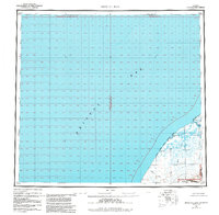
1963 Map of Bristol Bay
USGS Topo · Published 1988About this map
Bristol Bay and its coastal drainages dominate this 1960s study of the Alaska Peninsula shoreline. The map documents a landscape defined by expansive tidal systems and conservation boundaries, including the Alaska Maritime National Wildlife Refuge and the Anjakchak National Monument. Coastal landmarks such as Hook Lagoon and the extensive Tidal Flat near the mouth of the Cinder River highlight the dynamic interface between sea and land. Inland, a network of watercourses including Reindeer Creek and Mud Creek snake through the terrain. Small, isolated outposts and camps—recorded with names like Quirt, Teck, Yucca, Alfred, and Cabin—provide rare evidence of human presence in this region. This survey captures the remote character of the peninsula before the formal establishment of modern administrative boundaries was fully realized on older cartographic series.
Find a feature on this map
20 named features on this map. Tap any name to fly to it.
Don’t see what you’re looking for? This feature index may not catch every label — zoom into the map to look around manually.
Map Details
Editions of this 1963 Bristol Bay Map
3 editions found

Other maps of this area

1943 · Ugashik
USGS Topo · 1:250,000

1945 · Nushagak Bay
USGS Topo · 1:250,000

1948 · Ugashik
USGS Topo · 1:250,000

1949 · Ugashik
USGS Topo · 1:250,000

1949 · Nushagak Bay
USGS Topo · 1:250,000

1951 · Bristol Bay
USGS Topo · 1:250,000

1951 · Sutwik Island
USGS Topo · 1:250,000

1951 · Hagemeister Island
USGS Topo · 1:250,000

1951 · Nushagak Bay
USGS Topo · 1:250,000

1951 · Ugashik C-6
USGS Topo · 1:63,360