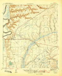
1945 Map of Bristol
USGS Topo · Published 1945About this map
Bristol sits atop the bluff line overlooking the Apalachicola River in this mid-1940s survey of Liberty County. The landscape is defined by the sharp transition from the elevated western riverbanks at Alum Bluff to the low-lying, complex drainage systems of Mud Swamp and Telogia Creek to the east. A prominent survey boundary, the Base Line, bisects the region east-to-west, while the vast historical tract of the Forbes Purchase influences the land lines throughout the eastern quadrangle. This period shows a largely rural infrastructure, with small family-named waterways like Deason Branch and Shuler Branch cutting through the terrain. Researchers will find interest in the isolated Cem location south of the main settlement and the detailed contouring of Lake Mystic, providing a clear look at the area's hydrology before later development.
Find a feature on this map
29 named features on this map. Tap any name to fly to it.
Don’t see what you’re looking for? This feature index may not catch every label — zoom into the map to look around manually.
Map Details
Editions of this 1945 Bristol Map
3 editions found
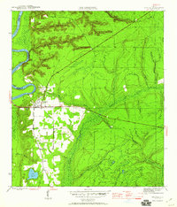
Other maps of this area

1945 · Blountstown
USGS Topo · 1:31,680

1945 · Hosford
USGS Topo · 1:31,680

1945 · Estiffanulga
USGS Topo · 1:31,680

1945 · Bristol
USGS Topo · 1:31,680

1945 · Woods
USGS Topo · 1:31,680

1945 · Telogia
USGS Topo · 1:24,000

1946 · Telogia
USGS Topo · 1:31,680

1952 · Altha East
USGS Topo · 1:24,000

1954 · Tallahassee
USGS Topo · 1:250,000

1955 · Rock Bluff
USGS Topo · 1:24,000