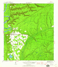
1945 Map of Bristol
USGS Topo · Published 1960About this map
Bristol serves as the focal point of this mid-1940s landscape, situated just east of the Apalachicola River where the prominent Alum Bluff overlooks the water. The survey reveals a terrain defined by complex hydrology, with numerous drainages like Beaverdam Creek and Telogia Creek cutting through the countryside. A significant surveying mark, the Base Line, bisects the region east-to-west, passing through the heart of the settlement. To the south, the clear waters of Lake Mystic contrast with the dense vegetation of Mud Swamp and Bird Pond. The map also delineates the historic extent of the Forbes Purchase, a massive land grant with boundaries supplied by the State of Florida. Genealogists may find interest in the local Cem located south of the town center, while the network of named branches, including Dawson Branch and Camp Branch, provides a detailed record of the local watershed prior to modern development.
Find a feature on this map
26 named features on this map. Tap any name to fly to it.
Don’t see what you’re looking for? This feature index may not catch every label — zoom into the map to look around manually.
Map Details
Editions of this 1945 Bristol Map
3 editions found
Other maps of this area

1945 · Blountstown
USGS Topo · 1:31,680

1945 · Hosford
USGS Topo · 1:31,680

1945 · Estiffanulga
USGS Topo · 1:31,680

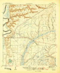
1945 · Bristol
USGS Topo · 1:31,680

1945 · Woods
USGS Topo · 1:31,680

1945 · Telogia
USGS Topo · 1:24,000

1946 · Telogia
USGS Topo · 1:31,680

1952 · Altha East
USGS Topo · 1:24,000

1954 · Tallahassee
USGS Topo · 1:250,000

1955 · Rock Bluff
USGS Topo · 1:24,000