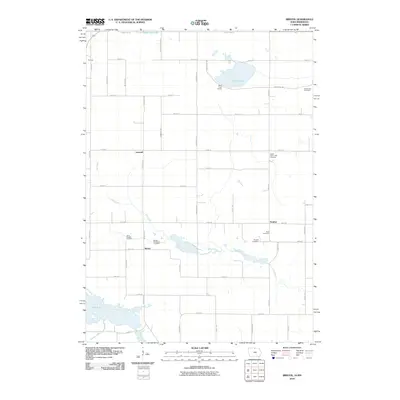
2010 Map of Bristol
USGS Topo · Published 2010About this map
Silver Lake and the winding course of Elk Creek define this rural landscape along the border of Iowa and Minnesota. The area is characterized by small, scattered settlements like Bristol, Somber, Norman, and Lansrud, which represent the agricultural heart of the region. A high density of local burial grounds, including Saint Patricks Cemetery, Bristol Protestant Cemetery, and the Sion Cemetery, provides significant data for genealogists tracing early families in the area. The landscape's hydrology is dominated by large bodies of water such as Rice Lake and State Line Lake, which straddles the northern boundary. Transportation is facilitated by a grid of rural routes including HWY-105 and numerous named avenues, reflecting the organized land division typical of the Upper Midwest during this era.
Find a feature on this map
49 named features on this map. Tap any name to fly to it.
Don’t see what you’re looking for? This feature index may not catch every label — zoom into the map to look around manually.
Map Details
Editions of this 2010 Bristol Map
This is the sole edition of this map. No revisions or reprints were ever made.
Other maps of this area

1954 · Albert Lea
USGS Topo · 1:62,500

1954 · Mason City
USGS Topo · 1:250,000

1955 · Wells
USGS Topo · 1:62,500

1957 · Mason City
USGS Topo · 1:250,000

1958 · Mason City
USGS Topo · 1:250,000

1972 · Fertile
USGS Topo · 1:24,000

1972 · Fertile NE
USGS Topo · 1:24,000

1972 · Bristol
USGS Topo · 1:24,000
1972 · Fertile SE
USGS Topo · 1:24,000

1972 · Pilot Knob
USGS Topo · 1:24,000