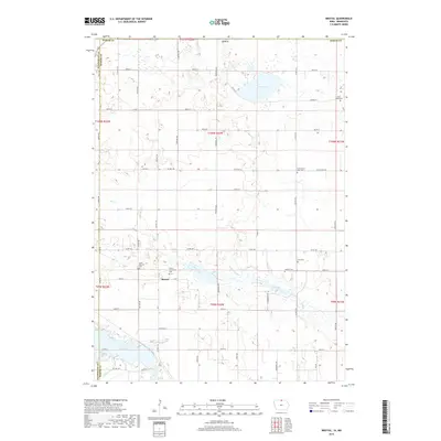
2018 Map of Bristol
USGS Topo · Published 2018About this map
Bristol stands as the central settlement in this borderland survey, where the agricultural grid of Worth County meets the Minnesota line. The landscape is defined by its numerous small burial grounds and extensive water networks, suggesting a long-established rural community with deep family roots. Silver Lake and Rice Lake anchor the north and south, while Elk Creek and Ditch Number 6 facilitate drainage across the tillable plains. Genealogists will find significant value in the detailed placement of the Saint Patricks Cem and the Bristol Protestant Cem, alongside smaller sites like the Slon Cem and Somber Cem. This record of the modern township reveals how the 19th-century settlement pattern of the Iowa-Minnesota border persists through maintained churchyards and a systematic road network that follows the original section lines.
Find a feature on this map
34 named features on this map. Tap any name to fly to it.
Don’t see what you’re looking for? This feature index may not catch every label — zoom into the map to look around manually.
Map Details
Editions of this 2018 Bristol Map
This is the sole edition of this map. No revisions or reprints were ever made.
Other maps of this area

1954 · Albert Lea
USGS Topo · 1:62,500

1954 · Mason City
USGS Topo · 1:250,000

1955 · Wells
USGS Topo · 1:62,500

1957 · Mason City
USGS Topo · 1:250,000

1958 · Mason City
USGS Topo · 1:250,000

1972 · Fertile
USGS Topo · 1:24,000

1972 · Fertile NE
USGS Topo · 1:24,000

1972 · Bristol
USGS Topo · 1:24,000
1972 · Fertile SE
USGS Topo · 1:24,000

1972 · Pilot Knob
USGS Topo · 1:24,000