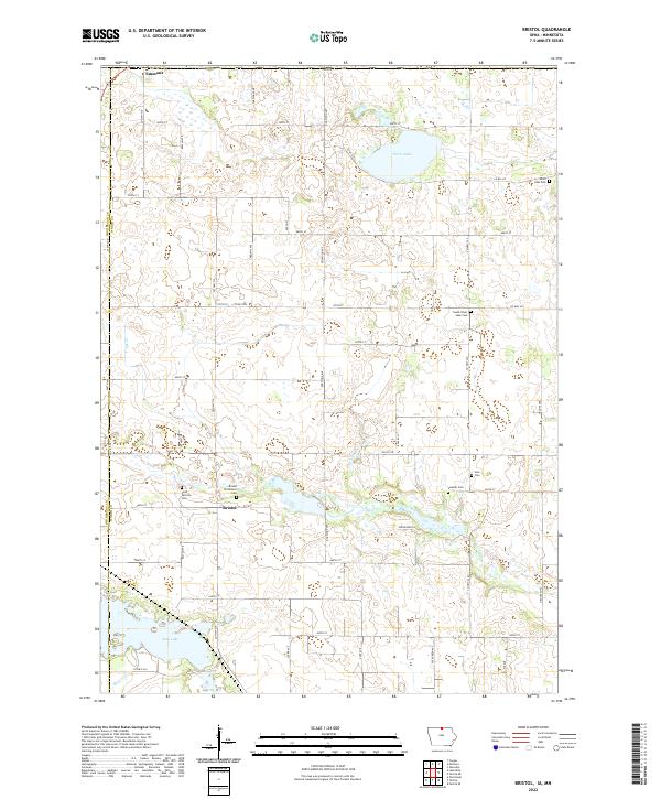
2022 Map of Bristol
USGS Topo · Published 2022About this map
The settlement of Bristol and the southern edge of Emmons anchor this map of the northern Iowa borderlands. The landscape is defined by a series of glacial lakes and wetlands, most notably Silver Lake in the northeast and Rice Lake in the southwest corner. The drainage of the area is managed through features like Ditch Number 6, which channels water toward Elk Cr.
Find a feature on this map
54 named features on this map. Tap any name to fly to it.
Don’t see what you’re looking for? This feature index may not catch every label — zoom into the map to look around manually.
Map Details
Editions of this 2022 Bristol Map
This is the sole edition of this map. No revisions or reprints were ever made.
Other maps of this area

1954 · Albert Lea
USGS Topo · 1:62,500

1954 · Mason City
USGS Topo · 1:250,000

1955 · Wells
USGS Topo · 1:62,500

1957 · Mason City
USGS Topo · 1:250,000

1958 · Mason City
USGS Topo · 1:250,000

1972 · Fertile
USGS Topo · 1:24,000

1972 · Fertile NE
USGS Topo · 1:24,000

1972 · Bristol
USGS Topo · 1:24,000
1972 · Fertile SE
USGS Topo · 1:24,000

1972 · Pilot Knob
USGS Topo · 1:24,000