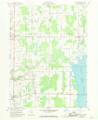
1960 Map of Bristolville
USGS Topo · Published 1971About this map
The eastern expanse of the Mosquito Creek Reservoir dominates this landscape within the Connecticut Western Reserve, a historic tract of northeastern Ohio. Settlement patterns in the early 1960s follow a regular grid of township roads, with long-established communities like North Bloomfield and Bristolville serving as local anchors. The map reveals a transition in land use, where agricultural fields and small woodlots meet the expansive Game Refuge Area along the reservoir's western shore. Genealogists will find a high density of rural burial grounds, including the Old Bristol Cem, Sager Memorial Cemetery, and Deacon Creek Cem, often located at remote crossroads. Industrial and transport history is represented by the Penn Central rail line cutting north-south through the center of Bloomfield and Bristol townships, connecting smaller hamlets like Lockwood and Spokane.
Find a feature on this map
46 named features on this map. Tap any name to fly to it.
Don’t see what you’re looking for? This feature index may not catch every label — zoom into the map to look around manually.
Map Details
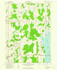
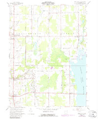
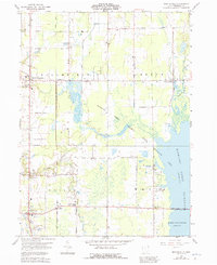
Editions of this 1960 Bristolville Map
4 editions found
Other maps of this area

1905 · Andover
USGS Topo · 1:48,000

1905 · Bristolville
USGS Topo · 1:62,500

1905 · Jefferson
USGS Topo · 1:62,500

1907 · Andover
USGS Topo · 1:62,500

1907 · Kinsman
USGS Topo · 1:62,500

1907 · Bristolville
USGS Topo · 1:62,500

1907 · Jefferson
USGS Topo · 1:62,500

1950 · Cleveland
USGS Topo · 1:250,000

1952 · West Farmington
USGS Topo · 1:24,000

1952 · Southington
USGS Topo · 1:24,000
Featured Places
- Bristol, Bristol Township
- Mecca Township, OH
- Bloomfield Township, OH
- Bloomfield, Bloomfield Township
- Greene, Greene Township