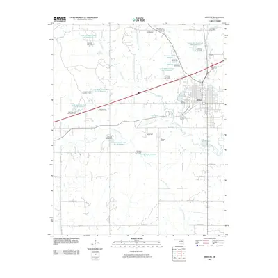
2009 Map of Bristow
USGS Topo · Published 2009About this map
Bristow serves as the central hub of this Oklahoma landscape, defined by a complex network of water management and transportation infrastructure. The town's layout is bordered to the north by the Bristow Interchange and the historic path of Old Hwy 66, while the modern industrial character is reflected in the Industrial Rd corridor. The surrounding terrain is heavily modified by numerous flood control structures along the Little Deep Fork Creek and its tributaries, including the Little Deep Fork Creek Site 31 Reservoir and several dams. Local history and community landmarks are anchored by Magnolia Cemetery on the northeastern edge of town and Durrant Cemetery to the south. Lake Massena and its accompanying Lake Massena Dam provide a significant recreational and hydrological feature just west of the main settlement, while the Jones Memorial Airport highlights the area's mid-century aviation infrastructure.
Find a feature on this map
60 named features on this map. Tap any name to fly to it.
Don’t see what you’re looking for? This feature index may not catch every label — zoom into the map to look around manually.
Map Details
Editions of this 2009 Bristow Map
This is the sole edition of this map. No revisions or reprints were ever made.
Other maps of this area

1901 · Nuyaka
USGS Topo · 1:125,000

1916 · Bristow
USGS Topo · 1:62,500

1929 · Stroud
USGS Topo · 1:62,500

1931 · Drumright
USGS Topo · 1:62,500

1932 · Stroud
USGS Topo · 1:62,500

1954 · Oklahoma City
USGS Topo · 1:250,000

1957 · Oklahoma City
USGS Topo · 1:250,000

1963 · Oklahoma City
USGS Topo · 1:250,000
1971 · Bellvue
USGS Topo · 1:24,000
1971 · Lake Heyburn
USGS Topo · 1:24,000