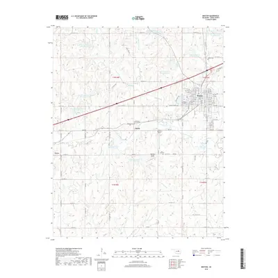
2018 Map of Bristow
USGS Topo · Published 2018About this map
Bristow stands as the primary hub in this Creek County landscape, where the legacy of early 20th-century transportation is visible through the alignment of Old Hwy 66. The area is notably dense with small family and community burial grounds, including the Harjo Cem, Eddie Harry Cem, and the historically significant Creek County Poor Farm Cem near Pulaski. These sites, along with the Poor Boy Cem further west, offer a detailed look at the rural settlement patterns of the region.
Find a feature on this map
95 named features on this map. Tap any name to fly to it.
Don’t see what you’re looking for? This feature index may not catch every label — zoom into the map to look around manually.
Map Details
Editions of this 2018 Bristow Map
This is the sole edition of this map. No revisions or reprints were ever made.
Other maps of this area

1901 · Nuyaka
USGS Topo · 1:125,000

1916 · Bristow
USGS Topo · 1:62,500

1929 · Stroud
USGS Topo · 1:62,500

1931 · Drumright
USGS Topo · 1:62,500

1932 · Stroud
USGS Topo · 1:62,500

1954 · Oklahoma City
USGS Topo · 1:250,000

1957 · Oklahoma City
USGS Topo · 1:250,000

1963 · Oklahoma City
USGS Topo · 1:250,000
1971 · Bellvue
USGS Topo · 1:24,000
1971 · Lake Heyburn
USGS Topo · 1:24,000