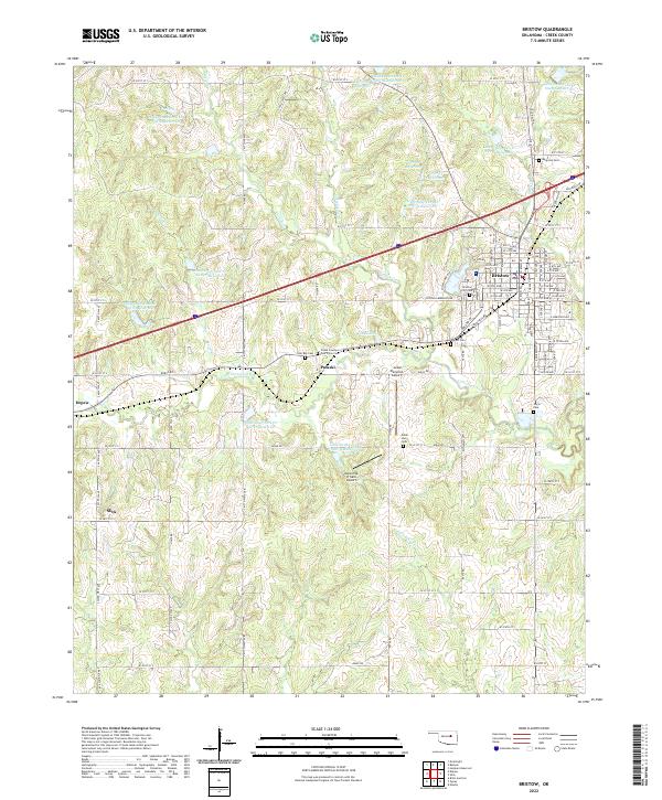
2022 Map of Bristow
USGS Topo · Published 2022About this map
Bristow serves as the primary hub of this eastern Oklahoma landscape, where the historic path of Old Hwy 66 cuts across the terrain alongside the newer interstate corridor. The town's grid is dense with street names like Roland St and Veterans Memorial Dr, reflecting its growth and civic organization. Surrounding the town, the rural reaches of Creek County are marked by a unique series of water management sites, specifically the numerous Little Deep Fork Creek Reservoirs that dot the drainage basins of Catfish Creek and Swan Creek.
Find a feature on this map
103 named features on this map. Tap any name to fly to it.
Don’t see what you’re looking for? This feature index may not catch every label — zoom into the map to look around manually.
Map Details
Editions of this 2022 Bristow Map
This is the sole edition of this map. No revisions or reprints were ever made.
Other maps of this area

1901 · Nuyaka
USGS Topo · 1:125,000

1916 · Bristow
USGS Topo · 1:62,500

1929 · Stroud
USGS Topo · 1:62,500

1931 · Drumright
USGS Topo · 1:62,500

1932 · Stroud
USGS Topo · 1:62,500

1954 · Oklahoma City
USGS Topo · 1:250,000

1957 · Oklahoma City
USGS Topo · 1:250,000

1963 · Oklahoma City
USGS Topo · 1:250,000
1971 · Bellvue
USGS Topo · 1:24,000
1971 · Lake Heyburn
USGS Topo · 1:24,000