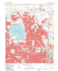
1986 Map of Britton
USGS Topo · Published 1987About this map
Lake Hefner dominates the western landscape of this mid-1980s suburban study, its eastern shoreline dotted with recreation spots like Stars and Stripes Park and Lakeshore Park. The era's intensive residential growth is visible in the dense street grids of The Village and Nichols Hills, contrasted with the remaining open tracts and numerous oil wells scattered throughout the north and east. The map captures a high concentration of civic and social infrastructure, from the sprawling grounds of the Rose Hill Burial Park to private institutions like the Oklahoma City Country Club and Heritage Hall Sch.
Find a feature on this map
99 named features on this map. Tap any name to fly to it.
Don’t see what you’re looking for? This feature index may not catch every label — zoom into the map to look around manually.
Map Details
Editions of this 1986 Britton Map
This is the sole edition of this map. No revisions or reprints were ever made.
Other maps of this area

1892 · Moore
USGS Topo · 1:62,500

1892 · Edmond
USGS Topo · 1:62,500

1892 · Kingfisher
USGS Topo · 1:125,000

1893 · Oklahoma City
USGS Topo · 1:62,500

1895 · Kingfisher
USGS Topo · 1:125,000

1898 · Purcell
USGS Topo · 1:125,000

1904 · Chickasha
USGS Topo · 1:125,000

1934 · Crutcho Creek
USGS Topo · 1:24,000

1934 · Moore
USGS Topo · 1:62,500

1935 · Spencer
USGS Topo · 1:24,000