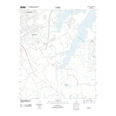
2010 Map of Britton
USGS Topo · Published 2010About this map
Joe Pool Lake dominates the northeastern landscape of this 2010 survey, illustrating the managed water systems of the Dallas-Fort Worth metroplex. The map captures the suburban expansion of Arlington and Mansfield, showing a transition from dense residential developments to the rural crossroads of Britton. Local history is anchored by several family and community burial sites, including Estes Cemetery, Cope Cemetery, and Pleasant Valley Cemetery, which are preserved amidst growing infrastructure and subdivisions. The drainage patterns are defined by many water bodies such as Walnut Creek, Soap Creek, and the Newton Branch, while landmarks like the Soil Conservation Service Site 11 Dam highlight the engineering required to support this rapidly evolving urban-rural interface.
Find a feature on this map
65 named features on this map. Tap any name to fly to it.
Don’t see what you’re looking for? This feature index may not catch every label — zoom into the map to look around manually.
Map Details
Editions of this 2010 Britton Map
This is the sole edition of this map. No revisions or reprints were ever made.
Other maps of this area

1891 · Dallas
USGS Topo · 1:125,000

1891 · Cleburne
USGS Topo · 1:125,000

1893 · Dallas
USGS Topo · 1:125,000

1894 · Cleburne
USGS Topo · 1:125,000

1894 · Fort Worth
USGS Topo · 1:125,000

1954 · Dallas
USGS Topo · 1:250,000

1958 · Dallas
USGS Topo · 1:250,000

1959 · Kennedale
USGS Topo · 1:24,000

1959 · Arlington
USGS Topo · 1:24,000

1959 · Cedar Hill
USGS Topo · 1:24,000