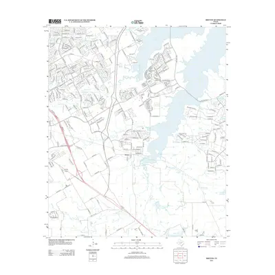
2013 Map of Britton
USGS Topo · Published 2013About this map
Britton sits at the heart of this North Texas landscape, where suburban expansion meets the winding drainages of the Mountain Cr watershed. By the early 21st century, the area shows a dense network of residential developments, particularly those bordering the extensive eastern shoreline of Joe Pool Lake. The map reveals a transition from these modern subdivisions back to more traditional landmarks, including several rural burial grounds such as Pleasant Valley Cem and Cope Cem. Numerous smaller waterways like Walnut Cr and Low Br meander through the terrain, illustrating the local topography before it reaches the larger reservoir. To the south, features like Gifford Hill Lake and Magic Valley Ranch Lake dot the landscape near the Ellis St corridor, reflecting the area's mix of private water bodies and public infrastructure.
Find a feature on this map
69 named features on this map. Tap any name to fly to it.
Don’t see what you’re looking for? This feature index may not catch every label — zoom into the map to look around manually.
Map Details
Editions of this 2013 Britton Map
This is the sole edition of this map. No revisions or reprints were ever made.
Other maps of this area

1891 · Dallas
USGS Topo · 1:125,000

1891 · Cleburne
USGS Topo · 1:125,000

1893 · Dallas
USGS Topo · 1:125,000

1894 · Cleburne
USGS Topo · 1:125,000

1894 · Fort Worth
USGS Topo · 1:125,000

1954 · Dallas
USGS Topo · 1:250,000

1958 · Dallas
USGS Topo · 1:250,000

1959 · Kennedale
USGS Topo · 1:24,000

1959 · Arlington
USGS Topo · 1:24,000

1959 · Cedar Hill
USGS Topo · 1:24,000