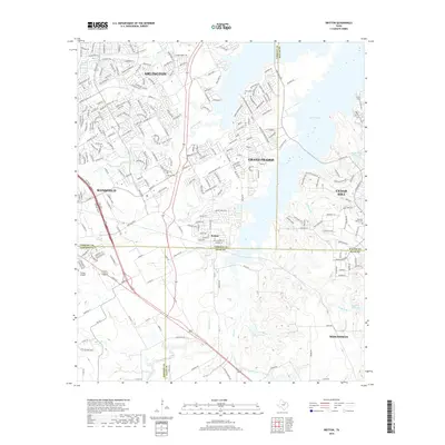
2019 Map of Britton
USGS Topo · Published 2019About this map
Britton sits at the junction of four Texas counties, serving as a focal point where the borders of Tarrant, Dallas, Ellis, and Johnson converge. This modern survey illustrates the suburban expansion and hydrological character of the region south of the Metroplex. The eastern portion of the sheet is dominated by the expansive Joe Pool Lake, which reaches into Cedar Hill and Grand Prairie. The terrain is deeply etched by a network of waterways including Walnut Creek, Mountain Cr, and Soap Cr, which drain toward the larger reservoirs.
Find a feature on this map
251 named features on this map. Tap any name to fly to it.
Don’t see what you’re looking for? This feature index may not catch every label — zoom into the map to look around manually.
Map Details
Editions of this 2019 Britton Map
This is the sole edition of this map. No revisions or reprints were ever made.
Other maps of this area

1891 · Dallas
USGS Topo · 1:125,000

1891 · Cleburne
USGS Topo · 1:125,000

1893 · Dallas
USGS Topo · 1:125,000

1894 · Cleburne
USGS Topo · 1:125,000

1894 · Fort Worth
USGS Topo · 1:125,000

1954 · Dallas
USGS Topo · 1:250,000

1958 · Dallas
USGS Topo · 1:250,000

1959 · Kennedale
USGS Topo · 1:24,000

1959 · Arlington
USGS Topo · 1:24,000

1959 · Cedar Hill
USGS Topo · 1:24,000