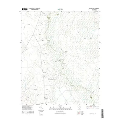
2017 Map of Brittons Neck
USGS Topo · Published 2017About this map
Brittons Neck stands as the primary settlement in this low-lying region where the Little Pee Dee River defines the border between Marion and Horry Counties. This coastal plain landscape is defined by its complex hydrography, characterized by dozens of oxbow lakes and named islands that shift within the river's course. Features such as Jack Lake, Gunter Lake, and Canoe Lake illustrate the river's historic meandering, while landmarks like Upper Dog Bluff and Lower Dog Bluff mark significant points along the western bank. The area transition into extensive wetland systems, including Brunson Swamp and Palmetto Swamp, which hem in the cultivated lands and local roads. This 2017 survey details the rural road network including Tobacco Bed Rd and Schoolhouse Rd, which connect the scattered homesteads and agricultural plots to the river crossings that have long dictated the area's geography.
Find a feature on this map
93 named features on this map. Tap any name to fly to it.
Don’t see what you’re looking for? This feature index may not catch every label — zoom into the map to look around manually.
Map Details
Editions of this 2017 Brittons Neck Map
This is the sole edition of this map. No revisions or reprints were ever made.
Other maps of this area

1943 · Dongola
USGS Topo · 1:24,000

1943 · Horry
USGS Topo · 1:24,000

1946 · Johnsonville
USGS Topo · 1:62,500

1947 · Friendship
USGS Topo · 1:24,000

1947 · Centenary
USGS Topo · 1:24,000

1948 · Galivants Ferry
USGS Topo · 1:24,000

1949 · Georgetown
USGS Topo · 1:250,000

1950 · Galivants Ferry
USGS Topo · 1:24,000

1953 · Florence
USGS Topo · 1:250,000

1954 · Florence
USGS Topo · 1:250,000
Featured Places
- Peters Ferry Landing, SC
- Brittons Neck, SC
- Hughes Landing, SC
- Dog Bluff Landing, SC
- Locust Tree Landing, SC