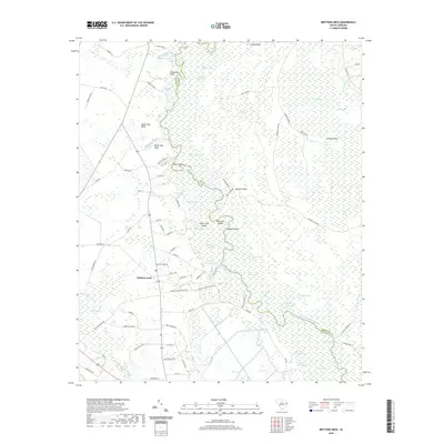
2020 Map of Brittons Neck
USGS Topo · Published 2020About this map
Brittons Neck sits at the heart of a complex fluvial landscape where the Little Pee Dee River meanders through an intricate network of cypress swamps and isolated islands. The river's winding course creates a series of oxbows and named water bodies such as Cypress Creek Lake, Newfound Lake, and Johnson Big Lake. The geography is defined by a succession of interior islands, including Patsy Island, Gunter Island, and Indigo Island, which suggest a history of seasonal flooding and changing water levels. Along the riverbanks, prominent features like Upper Dog Bluff and Lower Dog Bluff provide rare points of elevation above the surrounding Big Swamp and Brunson Swamp. The road network, featuring names like Tobacco Bed Rd and Alligator Rd, reflects the local agricultural and timber-based economy of this Marion and Horry County borderland.
Find a feature on this map
97 named features on this map. Tap any name to fly to it.
Don’t see what you’re looking for? This feature index may not catch every label — zoom into the map to look around manually.
Map Details
Editions of this 2020 Brittons Neck Map
This is the sole edition of this map. No revisions or reprints were ever made.
Other maps of this area

1943 · Dongola
USGS Topo · 1:24,000

1943 · Horry
USGS Topo · 1:24,000

1946 · Johnsonville
USGS Topo · 1:62,500

1947 · Friendship
USGS Topo · 1:24,000

1947 · Centenary
USGS Topo · 1:24,000

1948 · Galivants Ferry
USGS Topo · 1:24,000

1949 · Georgetown
USGS Topo · 1:250,000

1950 · Galivants Ferry
USGS Topo · 1:24,000

1953 · Florence
USGS Topo · 1:250,000

1954 · Florence
USGS Topo · 1:250,000
Featured Places
- Peters Ferry Landing, SC
- Brittons Neck, SC
- Hughes Landing, SC
- Dog Bluff Landing, SC
- Locust Tree Landing, SC