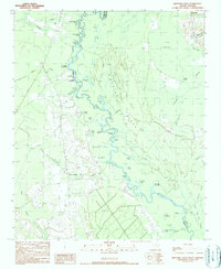
1990 Map of Brittons Neck
USGS Topo · Published 1990About this map
Brittons Neck stands as a significant point of interest in this low-lying riverine landscape, where the Little Pee Dee River winds through a complex network of oxbows and backwaters. The terrain is defined by its watery divisions, most notably the expansive Gunter Island and the broad Giles Bay. The map reveals a river-dependent economy and lifestyle through its numerous named access points, such as Dog Bluff Landing and Locust Tree Landing, which suggest a history of local transport and river trade.
Find a feature on this map
51 named features on this map. Tap any name to fly to it.
Don’t see what you’re looking for? This feature index may not catch every label — zoom into the map to look around manually.
Map Details
Editions of this 1990 Brittons Neck Map
This is the sole edition of this map. No revisions or reprints were ever made.
Other maps of this area

1943 · Dongola
USGS Topo · 1:24,000

1943 · Horry
USGS Topo · 1:24,000

1946 · Johnsonville
USGS Topo · 1:62,500

1947 · Friendship
USGS Topo · 1:24,000

1947 · Centenary
USGS Topo · 1:24,000

1948 · Galivants Ferry
USGS Topo · 1:24,000

1949 · Georgetown
USGS Topo · 1:250,000

1950 · Galivants Ferry
USGS Topo · 1:24,000

1953 · Florence
USGS Topo · 1:250,000

1954 · Florence
USGS Topo · 1:250,000