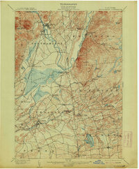
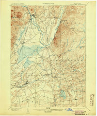
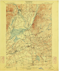
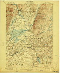
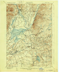
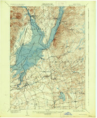
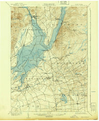
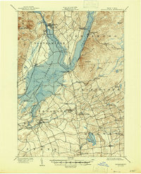
1902 Map of Broadalbin
USGS Topo · Published 1913About this map
Sacandaga Vly and the winding Sacandaga River dominate this landscape, documented years before the river was dammed to create the modern Great Sacandaga Lake. This 1899 survey captures a complex network of small manufacturing and milling hamlets like Union Mills, Hagedorns Mills, and Vail Mills that thrived along the numerous creeks feeding the valley floor. The northern terminus of the F. J. & G. R. R. serves Northville and the nearby Sacandaga Park, illustrating the region's late-19th-century role as both an industrial hub and a destination for summer residents.
Find a feature on this map
62 named features on this map. Tap any name to fly to it.
Don’t see what you’re looking for? This feature index may not catch every label — zoom into the map to look around manually.
Map Details
Editions of this 1902 Broadalbin Map
9 editions found
Other maps of this area

1893 · Schenectady
USGS Topo · 1:62,500

1895 · Schenectady
USGS Topo · 1:62,500

1895 · Amsterdam
USGS Topo · 1:62,500

1896 · Fonda
USGS Topo · 1:62,500

1898 · Schenectady
USGS Topo · 1:62,500

1898 · Fonda
USGS Topo · 1:62,500

1899 · Broadalbin
USGS Topo · 1:62,500

1902 · Broadalbin
USGS Topo · 1:62,500

1902 · Fonda
USGS Topo · 1:62,500

1902 · Saratoga
USGS Topo · 1:62,500