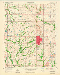
1955 Map of Broken Arrow
USGS Topo · Published 1965About this map
The growing community of Broken Arrow sits at the heart of this mid-century survey, showing the city's early street grid anchored by Broadway, Main St, and Cedar St. The landscape reveals a transition from agricultural land to suburban development, with several local institutions established to serve the population, including St Anne Sch, Immanuel Sch, and South Side Sch. Beyond the central town, the presence of numerous Oil Wells and a Strip Mine in the southeast corner near the Tulsa Co Wagoner Co line points to the region's industrial foundations.
Find a feature on this map
37 named features on this map. Tap any name to fly to it.
Don’t see what you’re looking for? This feature index may not catch every label — zoom into the map to look around manually.
Map Details
Editions of this 1955 Broken Arrow Map
5 editions found

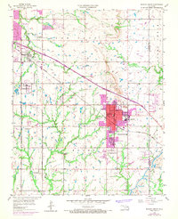
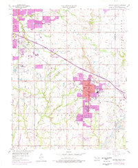

Other maps of this area

1896 · Okmulgee
USGS Topo · 1:125,000

1900 · Okmulgee
USGS Topo · 1:125,000

1901 · Claremore
USGS Topo · 1:125,000

1914 · Claremore
USGS Topo · 1:125,000

1916 · Claremore
USGS Topo · 1:125,000

1946 · Fort Smith
USGS Topo · 1:250,000
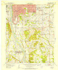
1952 · Jenks
USGS Topo · 1:24,000

1954 · Tulsa
USGS Topo · 1:250,000

1954 · Tulsa
USGS Topo · 1:24,000

1955 · Mingo
USGS Topo · 1:24,000