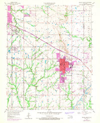
1955 Map of Broken Arrow
USGS Topo · Published 1968About this map
Broken Arrow serves as the focal point of this mid-century survey, showing the city's residential core and expanding infrastructure along the Missouri Kansas Texas railroad. The landscape is a transition between the suburban reach of Tulsa and active extraction sites, evidenced by numerous Oil Wells and a significant Strip Mine in the southeast corner. Local community life is rooted in a dense network of neighborhood institutions, including South Side Sch, Haskell Sch, and St Anne Sch.
Find a feature on this map
39 named features on this map. Tap any name to fly to it.
Don’t see what you’re looking for? This feature index may not catch every label — zoom into the map to look around manually.
Map Details
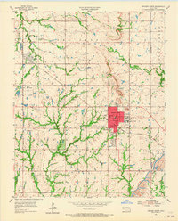
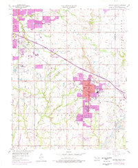
Editions of this 1955 Broken Arrow Map
5 editions found


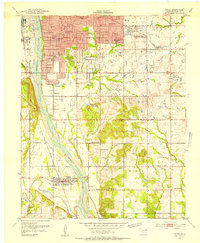
Other maps of this area

1896 · Okmulgee
USGS Topo · 1:125,000

1900 · Okmulgee
USGS Topo · 1:125,000

1901 · Claremore
USGS Topo · 1:125,000

1914 · Claremore
USGS Topo · 1:125,000

1916 · Claremore
USGS Topo · 1:125,000

1946 · Fort Smith
USGS Topo · 1:250,000
1952 · Jenks
USGS Topo · 1:24,000

1954 · Tulsa
USGS Topo · 1:250,000

1954 · Tulsa
USGS Topo · 1:24,000

1955 · Mingo
USGS Topo · 1:24,000