
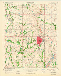
1955 Map of Broken Arrow
USGS Topo · Published 1982About this map
Broken Arrow serves as the focal point of this mid-century Oklahoma landscape, showing the town's early footprint before decades of rapid expansion. The map details the transition from rural agricultural land to suburban development, with the Missouri Kansas Texas railroad cutting a diagonal path through the terrain. Evidence of the region's resource extraction is visible in the numerous Oil Wells and a Strip Mine located near Broken Arrow Creek. Educational and community anchors like Immanuel Sch, South Side Sch, and St Anne Sch highlight the growing residential clusters. To the west, the edge of Tulsa begins to encroch, while smaller settlements like Alsuma and Union maintain their distinct identities. Recreation and memorial sites are well-established, including the Floral Haven Memorial Gardens and the Eighty-first Street Airpark, illustrating the diverse land use as the metropolitan area planning commission began shaping the region's future.
Find a feature on this map
42 named features on this map. Tap any name to fly to it.
Don’t see what you’re looking for? This feature index may not catch every label — zoom into the map to look around manually.
Map Details
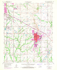
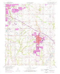
Editions of this 1955 Broken Arrow Map
5 editions found

Other maps of this area

1896 · Okmulgee
USGS Topo · 1:125,000

1900 · Okmulgee
USGS Topo · 1:125,000

1901 · Claremore
USGS Topo · 1:125,000

1914 · Claremore
USGS Topo · 1:125,000

1916 · Claremore
USGS Topo · 1:125,000

1946 · Fort Smith
USGS Topo · 1:250,000
1952 · Jenks
USGS Topo · 1:24,000

1954 · Tulsa
USGS Topo · 1:250,000

1954 · Tulsa
USGS Topo · 1:24,000

1955 · Mingo
USGS Topo · 1:24,000