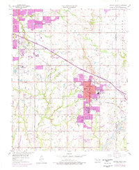
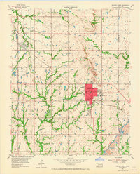
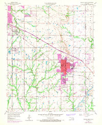
1955 Map of Broken Arrow
USGS Topo · Published 1976About this map
Broken Arrow and the burgeoning eastern outskirts of Tulsa define this mid-century Oklahoma landscape, where suburban expansion meets an established energy and agricultural economy. The survey captures the community as it shifts from a rail-focused town along the Missouri Kansas Texas railroad toward modern residential developments. Numerous Oil Well and Oil Wells are scattered across sections like Lynn Lane and Boles, indicating the persistent role of the petroleum industry in the local economy. Education and community life are well-documented through several neighborhood campuses, including South Side Sch and Haskell Sch. Aviation presence is notable for the era, with both Eighty-first Street Airpark and Cotton Airfield serving the region. To the southeast, industrial activity is marked by a Strip Mine near Camp Russell, illustrating the diverse extractive operations that shaped the land use during this period of Oklahoma's growth.
Find a feature on this map
42 named features on this map. Tap any name to fly to it.
Don’t see what you’re looking for? This feature index may not catch every label — zoom into the map to look around manually.
Map Details
Editions of this 1955 Broken Arrow Map
5 editions found


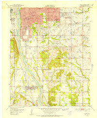
Other maps of this area

1896 · Okmulgee
USGS Topo · 1:125,000

1900 · Okmulgee
USGS Topo · 1:125,000

1901 · Claremore
USGS Topo · 1:125,000

1914 · Claremore
USGS Topo · 1:125,000

1916 · Claremore
USGS Topo · 1:125,000

1946 · Fort Smith
USGS Topo · 1:250,000
1952 · Jenks
USGS Topo · 1:24,000

1954 · Tulsa
USGS Topo · 1:250,000

1954 · Tulsa
USGS Topo · 1:24,000

1955 · Mingo
USGS Topo · 1:24,000