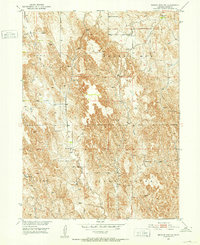
1951 Map of Broken Bow SW
USGS Topo · Published 1952About this map
Union Valley and the elevated plains of Ryno Table define the rural character of this Custer County landscape during the early 1950s. The area is marked by a network of small, localized country schools serving the farming and ranching families of the Missouri River Basin. These institutions, including Fleming Valley Sch, Cottage Sch, and Happy Hill Sch, suggest a decentralized educational system that was vital to the mid-century agricultural community before school consolidation changed the rural map.
Find a feature on this map
11 named features on this map. Tap any name to fly to it.
Don’t see what you’re looking for? This feature index may not catch every label — zoom into the map to look around manually.
Map Details
Editions of this 1951 Broken Bow SW Map
3 editions found
Other maps of this area

1951 · Broken Bow NE
USGS Topo · 1:24,000

1951 · Broken Bow SW
USGS Topo · 1:24,000

1951 · Broken Bow
USGS Topo · 1:24,000

1951 · Broken Bow SE
USGS Topo · 1:24,000

1951 · Merna
USGS Topo · 1:24,000

1951 · Eddyville NE
USGS Topo · 1:24,000

1951 · Callaway SE
USGS Topo · 1:24,000

1951 · Eddyville NW
USGS Topo · 1:24,000

1951 · Oconto
USGS Topo · 1:24,000

1955 · Broken Bow
USGS Topo · 1:250,000