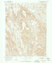
1951 Map of Broken Bow SW
USGS Topo · Published 1970About this map
Union Valley and the elevated Ryno Table define the agricultural geography of this part of Custer County during the early 1950s. The landscape is characterized by a high density of small rural schoolhouses, suggesting a period of robust local community life before the widespread consolidation of country districts. Tracing the path of Ash Creek, researchers will find Ash Creek Sch and Plainview Sch positioned to serve the dispersed farmsteads of the region. Other educational landmarks like Fleming Valley Sch, Cottage Sch, and Happy Hill Sch are scattered across the terrain, providing precise geographic anchors for genealogists looking for family history in the Custer area. The map illustrates a Missouri River Basin development era landscape dominated by windmills and unimproved roads, reflecting the post-war state of Nebraska's rural infrastructure.
Find a feature on this map
10 named features on this map. Tap any name to fly to it.
Don’t see what you’re looking for? This feature index may not catch every label — zoom into the map to look around manually.
Map Details
Editions of this 1951 Broken Bow SW Map
3 editions found
Other maps of this area

1951 · Broken Bow NE
USGS Topo · 1:24,000

1951 · Broken Bow SW
USGS Topo · 1:24,000

1951 · Broken Bow
USGS Topo · 1:24,000

1951 · Broken Bow SE
USGS Topo · 1:24,000

1951 · Merna
USGS Topo · 1:24,000

1951 · Eddyville NE
USGS Topo · 1:24,000

1951 · Callaway SE
USGS Topo · 1:24,000

1951 · Eddyville NW
USGS Topo · 1:24,000

1951 · Oconto
USGS Topo · 1:24,000

1955 · Broken Bow
USGS Topo · 1:250,000