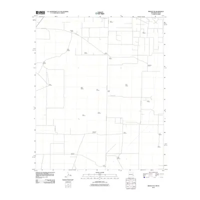
2010 Map of Bronco NE
USGS Topo · Published 2010About this map
State Line Rd serves as the primary longitudinal axis for this high plains landscape, marking the border between New Mexico and Texas. The infrastructure here is defined by an extensive network of water management, visible through numerous named wells and pumps such as Prairie Chicken Windmill, Pardnership Windmill, and North Beall Windmill. These features indicate the vital role of groundwater for ranching operations like Standefer Ranch and Gilliam Ranch in a region with minimal surface water. Beyond agriculture, the presence of the Walker Oil Field on the Texas side of the boundary highlights the energy production that drives the local economy. The grid-like arrangement of routes such as County Rd-179 and Underwood Rd provides a clear view of how these remote rangelands were partitioned and managed in the early 21st century.
Find a feature on this map
29 named features on this map. Tap any name to fly to it.
Don’t see what you’re looking for? This feature index may not catch every label — zoom into the map to look around manually.
Map Details
Editions of this 2010 Bronco NE Map
This is the sole edition of this map. No revisions or reprints were ever made.
Other maps of this area

1954 · Brownfield
USGS Topo · 1:250,000

1958 · Brownfield
USGS Topo · 1:250,000

1962 · Brownfield
USGS Topo · 1:250,000

1970 · Bronco NE
USGS Topo · 1:24,000

1970 · Walking Cane Ranch
USGS Topo · 1:24,000

1970 · Gladiola
USGS Topo · 1:24,000

1970 · Bronco
USGS Topo · 1:24,000

1970 · Bledsoe
USGS Topo · 1:24,000

1970 · Morton SW
USGS Topo · 1:24,000
1971 · Two B Ranch NW
USGS Topo · 1:24,000