
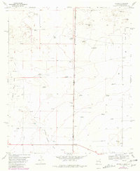
1970 Map of Bronco
USGS Topo · Published 1972About this map
The small settlement of Bronco sits directly on the state line, where the high plains of New Mexico meet the Texas Panhandle. This arid, industrial landscape is defined by the extraction of natural resources and the necessity of water for livestock, evidenced by the extensive Gladiola Oil Field and numerous named windmills dotting the quadrangle. Significant infrastructure including a Pumping Station and a major Pipeline cross the terrain, supporting the region's energy production in the early 1970s.
Find a feature on this map
42 named features on this map. Tap any name to fly to it.
Don’t see what you’re looking for? This feature index may not catch every label — zoom into the map to look around manually.
Map Details
Editions of this 1970 Bronco Map
2 editions found
Other maps of this area

1954 · Brownfield
USGS Topo · 1:250,000

1958 · Brownfield
USGS Topo · 1:250,000

1962 · Brownfield
USGS Topo · 1:250,000

1970 · Prairieview NE
USGS Topo · 1:24,000

1970 · Bronco NE
USGS Topo · 1:24,000

1970 · Prairieview NW
USGS Topo · 1:24,000

1970 · Walking Cane Ranch
USGS Topo · 1:24,000

1970 · Gladiola
USGS Topo · 1:24,000

1971 · Plains NW
USGS Topo · 1:24,000
1971 · Two B Ranch NW
USGS Topo · 1:24,000