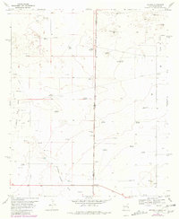
1970 Map of Bronco
USGS Topo · Published 1981About this map
Bronco sits at the intersection of the state line and a major thoroughfare, serving as a primary point of interest on this high plains borderland. The landscape is defined by the ephemeral Sulphur Springs Draw and a complex network of resource extraction and water management. Scattered throughout the terrain are numerous named windmills such as High Lonesome Windmill, Dillberry Windmill, and Rumph Windmill, which highlight the critical nature of groundwater for ranching operations. To the south, Mexican Hill provides a distinct topographic change near a lone Grave and a local School. The presence of an Oil Field and a Pumping Station indicates the industrial layer of the economy, while specialized features like Oho Tank and a substation point to the technical infrastructure required to sustain the remote settlements along the New Mexico-Texas boundary.
Find a feature on this map
40 named features on this map. Tap any name to fly to it.
Don’t see what you’re looking for? This feature index may not catch every label — zoom into the map to look around manually.
Map Details
Editions of this 1970 Bronco Map
2 editions found
Other maps of this area

1954 · Brownfield
USGS Topo · 1:250,000

1958 · Brownfield
USGS Topo · 1:250,000

1962 · Brownfield
USGS Topo · 1:250,000

1970 · Prairieview NE
USGS Topo · 1:24,000

1970 · Bronco NE
USGS Topo · 1:24,000

1970 · Prairieview NW
USGS Topo · 1:24,000

1970 · Walking Cane Ranch
USGS Topo · 1:24,000

1970 · Gladiola
USGS Topo · 1:24,000

1970 · Bronco
USGS Topo · 1:24,000

1971 · Plains NW
USGS Topo · 1:24,000