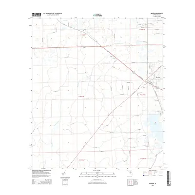
2015 Map of Bronson
USGS Topo · Published 2015About this map
The town of Bronson serves as the focal point of this Levy County landscape, situated at the junction of several primary regional arteries including NE Highway 27 Alt and SR-339. The town's grid is clearly defined, featuring local landmarks such as Bronson Cem and School St. This survey illustrates a terrain dominated by low-lying wetlands and significant water features, most notably the winding path of the Waccasassa River as it moves through the western half of the quadrangle. Scattered throughout the area are several distinct water bodies, including Tom Pond in the north and the expansive Chunky Pond to the southeast. The rural character of the region is punctuated by notable natural points like Blue Springs, which emerges near the center of the survey. The transport network reflects the area's development, with residential corridors like Pennsylvania Ave and N Hathaway Ave extending from the central settlement into the surrounding cypress and pine landscape.
Find a feature on this map
56 named features on this map. Tap any name to fly to it.
Don’t see what you’re looking for? This feature index may not catch every label — zoom into the map to look around manually.
Map Details
Editions of this 2015 Bronson Map
This is the sole edition of this map. No revisions or reprints were ever made.
Other maps of this area

1954 · Chiefland
USGS Topo · 1:24,000

1954 · Otter Creek
USGS Topo · 1:24,000

1954 · Bronson
USGS Topo · 1:24,000

1954 · Bronson SW
USGS Topo · 1:24,000

1954 · Gainesville
USGS Topo · 1:250,000

1955 · Bronson NE
USGS Topo · 1:24,000

1955 · Bronson SE
USGS Topo · 1:24,000
1957 · Bronson SE
USGS Topo · 1:25,000

1958 · Gainesville
USGS Topo · 1:250,000

1959 · Gainesville
USGS Topo · 1:250,000